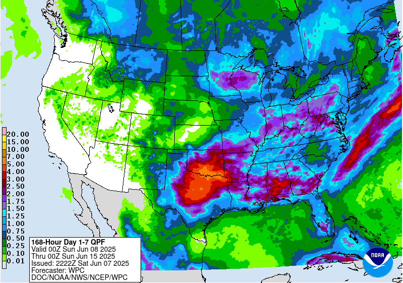
The latest 7-day QPF map shows that everywhere in the region should get some rain this week. However, northern South Carolina and central North Carolina are likely to see the least, with expected amounts of less than half an inch. Other areas could see quite a bit more, and this will help to further reduce the areas of drought that remain in the region (see related story today). The heaviest amounts of rain should fall over the next couple of days with lighter amounts (and probably more scattered rainfall as well, since it will be convective rain and not frontal rain) later in the week. According to NOAA’s Climate Prediction Center, week 2 should be warmer than normal with a slight tilt towards wetter than normal conditions. Weeks 3 and 4 should be wetter than normal, particularly in the southern half of the region, and warmer than normal especially along the East Coast.