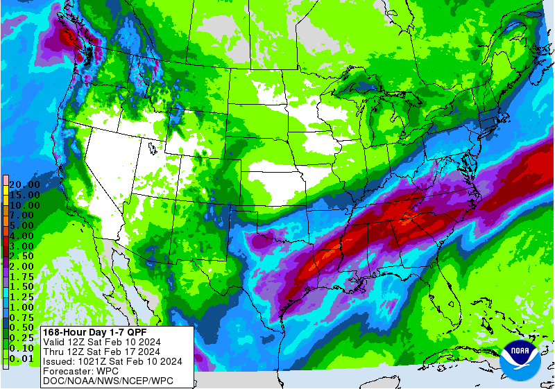
Once again, rain is expected to fall across a lot of the Southeast this weekend with the latest storm system moving across the region from west to east. On Saturday rain will fall mostly in the western sections of the Southeast, but the front will move to the east overnight, bringing rain to areas farther east on Sunday. The Florida peninsula will be largely missed by the heaviest rain, but some areas along the main storm front could see several inches. Midweek looks dry for all before the next system moves in late in the week. In week 2 it looks like the rainiest weather will be pushed to the south, leaving drier and cooler air across most of the region. These cooler temperatures are expected to last into early March, which fruit farmers hope will reduce the chance of an earlier bud break and the potential for another freeze that could damage their crops.