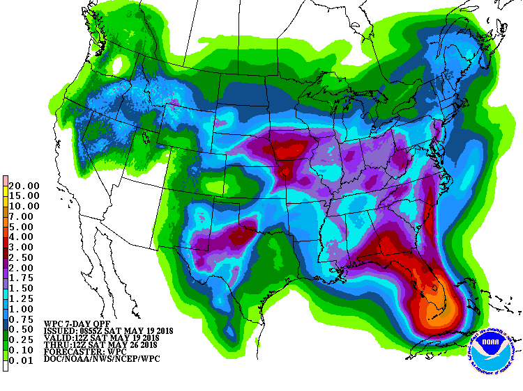
The latest 7-day QPF forecast indicates that the current rainy pattern is likely to continue for at least the next week, with rainfall amounts of up to several inches of rain in isolated locations likely to occur as scattered showers and thunderstorms continue to move through the region. The highest amounts of rain are expected in southern Florida, but most of the region will be well watered. I expect to see drought reduced or removed from a lot of the Southeast over the next couple of weeks as this wet pattern continues.
Also for those planning ahead for Memorial Day weekend, there are some signs that the Atlantic tropical season may begin early and bring a tropical storm (which would be named Alberto) to the Southeast coast. Still too early to be specific, but keep watching forecasts if you have plans that depend on dry conditions.