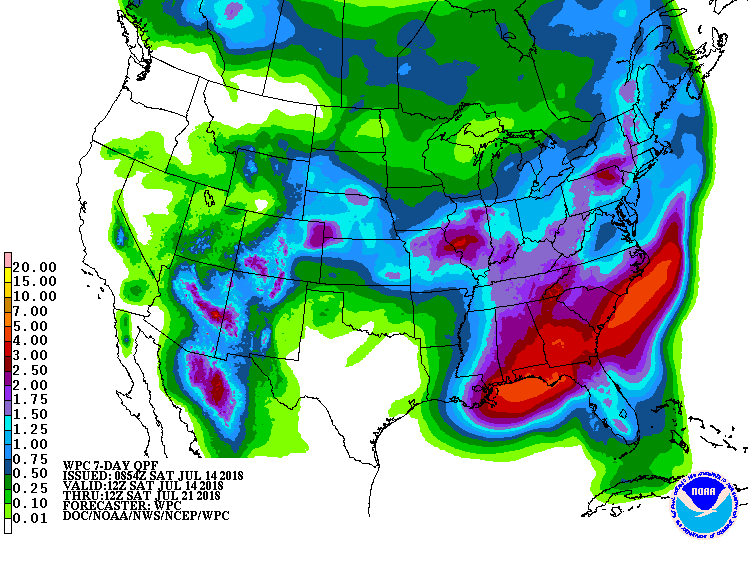
The latest 7-day QPF map shows at least a couple of inches of rain this week across the region. It’s hard to look at the forecast maps and see any 24-hour periods with no rain at all. The driest areas are likely to be northern Alabama and NW Georgia and the central Carolinas and Virginia where things are already abnormally dry. A look ahead to the next week shows that there may be some slightly longer dry spells then, but no big high pressure centers over the region. Of course in summertime rain, thunderstorms may hit or miss your local area, so there will be a lot of variability, even over short distances. Temperatures may be slightly on the cool side from all of the clouds associated with the rain.