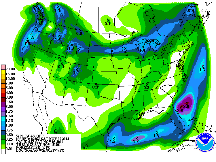
The 7-day QPF map shows another dry week in store for most of the Southeast. The only exception will be the peninsula of Florida, which will see a lot of rain along the boundary of the unusually cold air that is expected to move into the area during the week. I’ve discussed this outbreak of cold air in previous posts. It is related to the explosive transition of Super Typhoon Nuri into an amazingly strong extratropical system that set a new record for low pressure in the Bering Sea yesterday. The strong low is shifting the long-wave atmospheric patterns to create a trough of unusually cold air over the Eastern US which will bring much colder than normal temperatures into the region later this week. Everyone bundle up!