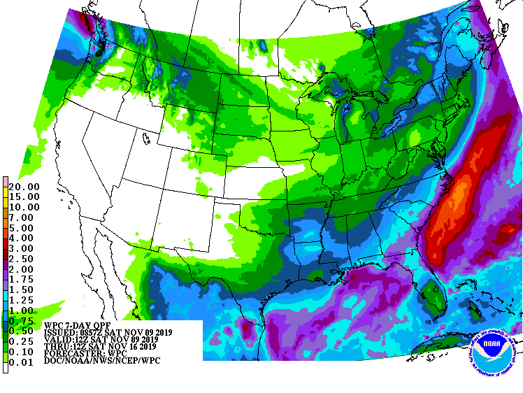
The latest 7-day QPF map shows that the next three days should be mostly dry, with a small chance of light showers by mid-week (along with a blast of cold air) and the highest likelihood of rain in the Thursday through Saturday period, with many areas expected to receive a half-inch or more. The heaviest rains should occur in northern Florida and southern Georgia and along the East Coast. Northern Alabama will see the lightest amounts as the front stays mostly to their south. Southern Florida is also expected to be fairly dry.