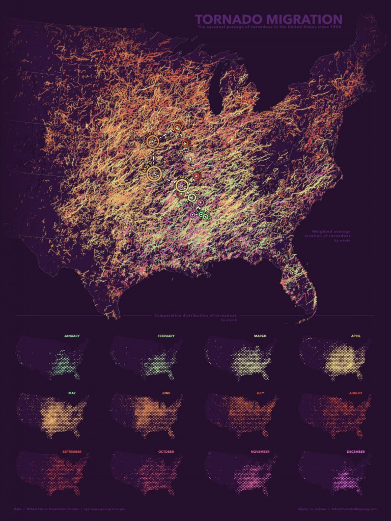
The Adventures in Mapping blog has a story this week about how the season migration in tornado events can be mapped just like the migration of wildebeest or other wandering animal or bird species. Tornadoes undergo a seasonal cycle of occurrence that is ultimately related to the sun’s angle, which changes over the course of the year due to the tilt of the earth. The energy from the sun drive temperature differences across the earth which contribute to tornado formation. You can see the movement in the monthly maps of tornado occurrence the blogger provides at https://adventuresinmapping.com/2018/03/29/tornado-migration/.