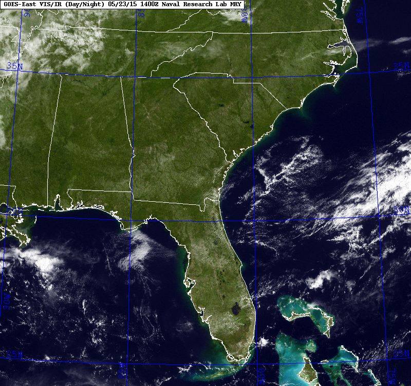
The satellite picture this morning showed the Southeast in all its glory, unmasked by clouds. This image, taken from the GOES-East geostationary satellite, is so crisp that you can see river valleys and even the “fall line” cutting through central Georgia, South Carolina and North Carolina.
The clear conditions are courtesy of high pressure, which is preventing cloud development, and the cool, dry air mass that followed the cold front into the region earlier this week. Enjoy these cool mornings! Warmer, wetter weather will return soon. You can get more images at https://www.goes.noaa.gov/browsh2.html or https://www.ssec.wisc.edu/data/.