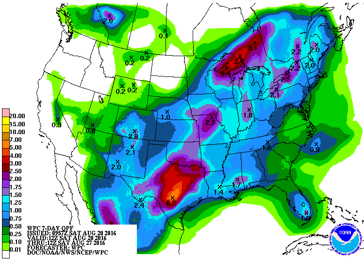
The latest QPF shows that conditions across the Southeast should be drier in the next seven days as a cold front moves through the area and shuts down some of the daily afternoon convection that has brought rain to the area. We will still see a chance of scattered showers for most days in the week, but rainfall totals in most places will be less than half an inch except in scattered downpours. Weeks 2-4 also look like below normal rainfall and above normal temperatures overall are likely to continue.
One thing to note is that the tropics have become more active, and at least some paths of potential tropical storms could affect the Southeast near the end of the month, although the forecasts so far out are highly speculative. Keep watching, and I will update here in the blog when impacts become more likely.