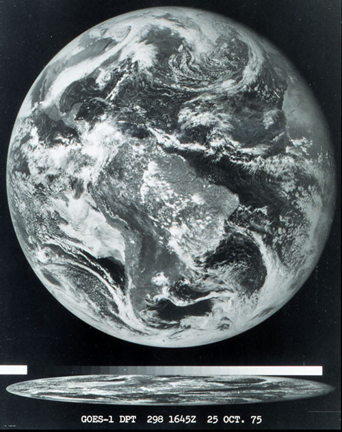
Forty years ago today, on October 16, 1975, NOAA’s first Geostationary Operational Environmental Satellite was launched from Cape Canaveral Air Force Station in Florida. Known as GOES-A when it launched, the satellite was designated GOES-1 once operational.
GOES stands for Geostationary Orbiting Earth Satellite. GOES-1 returned its first image only nine days later on October 25, and quickly became an essential tool used by the NOAA’s National Weather Service.
The GOES satellite system has been continuously monitoring the Earth since that time, sending back regular pictures of the entire half of the earth facing the satellite and allowing scientists to watch weather and climate evolve around the world. It observes light coming from the Earth at several different wavelengths, allowing 24 hour imagery and the study of cloud properties among other things. Satellite measurements from a variety of satellites now provide more data to weather forecast models than any other type of observation.
You can read more about how the GOES satellites work and their history at: