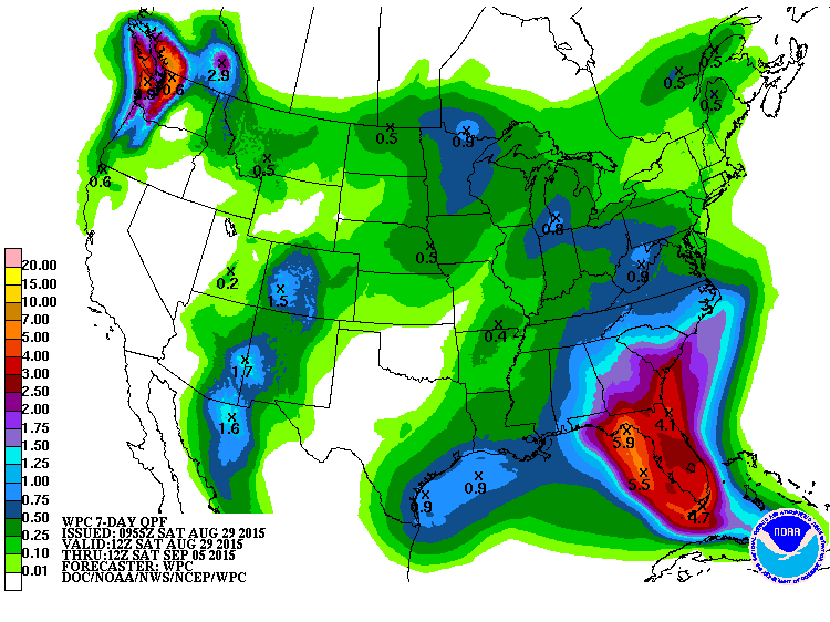
The latest 7-day QPF forecast shows the potential for heavy rain this week due to the possible movement of Tropical Storm Erika (or its remains) into the region by mid-week. Areas where Erika has already passed have seen intense rainfall, flooding and mudslides that have caused some deaths in Dominica as well as the Dominican Republic.
Note that because the forecasts for the track and intensity of the storm have not been consistent and have been trending westward over the last two days, this is a low confidence forecast. If the westward trend continues, a lot of the Southeast could miss out on the heaviest rains altogether, but since the Florida peninsula and southern Georgia are on the east side of the current track of the storm, they are still likely to see gusty winds and scattered heavy rain from the outskirts of the storm. If the current track holds constant, then heavy rain is likely for Florida and southern Georgia and possibly Alabama and South Carolina as Erika creeps through the area.
Not a good week to harvest anything that needs some drying time, like hay or peanuts. If you have equipment or livestock in low-lying areas and you have not moved them yet, now is a good time to do it.