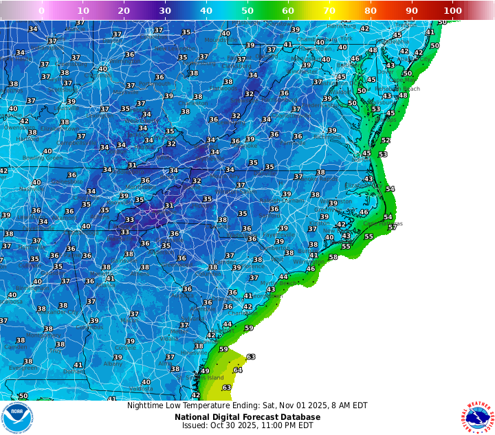
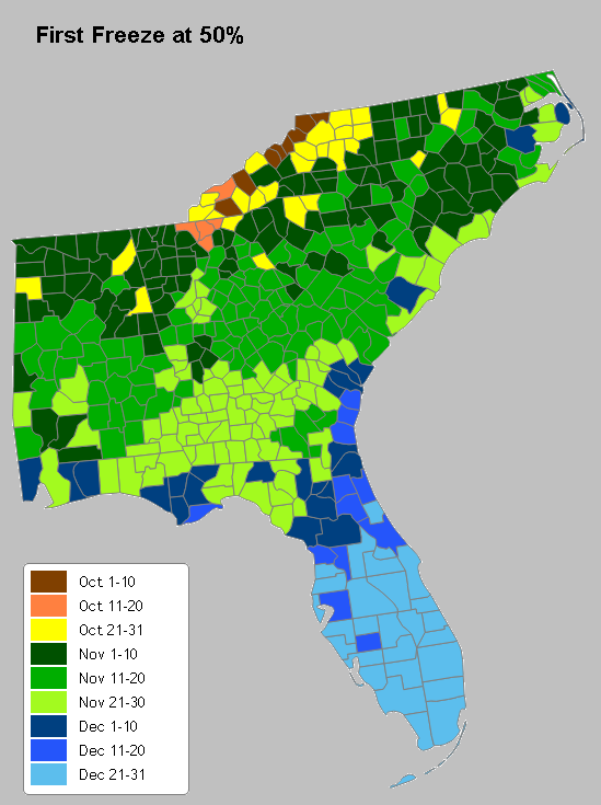
With the passage of a cold front through the region on Wednesday, cooler and drier air has filtered into the region. Once the clouds move out, radiational cooling should drop the temperature in many places into the 30s, leading to the probability of frost. Most places will not get down to freezing except the higher elevations and some valleys where cold mountain air can drain, but some frost damage could occur to tender plants. Things should start to slowly warm up again after Saturday. The long range forecast currently indicates that a freeze is not likely in the northern part of the region until mid-November, but if you live in an area that is prone to cold temperatures, watch the forecasts carefully. So far, only higher elevations in Virginia and North Carolina have experienced freezing temperatures. The map from AgroClimate.org at the bottom shows the average date of the first fall freeze. You can see more maps at http://agroclimate.org/tools/freeze-risk-probabilities/