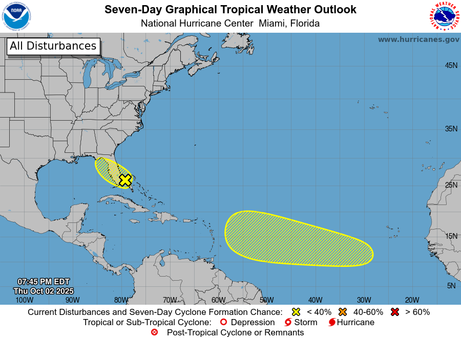
The latest 7-day tropical outlook shows two areas of potential interest. The first is an area over the Florida Peninsula which has just a 10 percent chance of developing in the next week. This area is mostly expected to bring rain to the East Coast of Florida with lesser amounts on the West Coat and up into the Panhandle and adjoining areas of Georgia and Alabama. There is a small chance it could develop tropical characteristics in the next few days. I don’t think this will have much impact on the areas of drought in southern GA and AL and in northern Florida, though. The other area is in the central Atlantic and has a 30% chance of developing in the next week, up from 20% earlier today. This area is expected to continue to track to the west or west-northwest for the next week. Since it is so far out, there is no immediate threat and it may end up following the same path as Erin and Humberto, although it is too early to say.
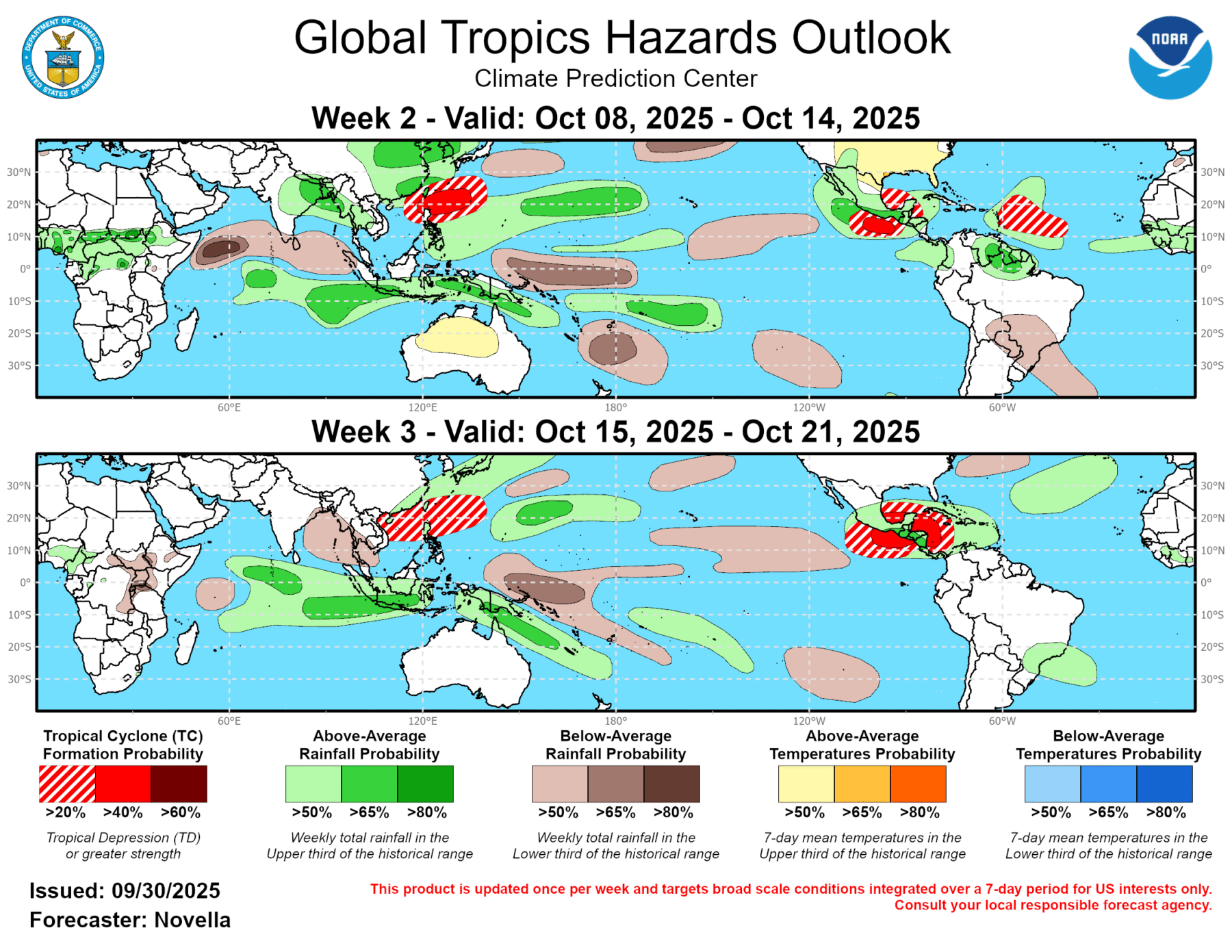
In mid-October, the Climate Prediction Center is indicating there is a good chance of development in the Southern Gulf or Caribbean Sea. This is a frequent location of development as we go into the fall, so it will bear watching. Again, nothing to worry about at this point, just something to watch.