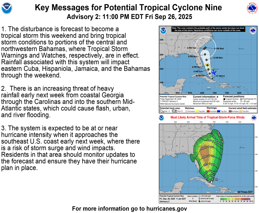
At 5 pm EDT today, Investigation 94 officially became Potential Tropical Cyclone 9, indicating that we are getting close enough to a named storm for the National Hurricane Center to start issuing advisories, a forecast cone, and the expected wind field for the storm. It is organizing north of Hispanola and Cuba now and should be named in the next 24-48 hours once a closed low is found. The key messages, including a forecast cone and likely arrival time of tropical storm force winds, is shown below.
While this cone and wind field map look like they are well established, the actual forecast is very uncertain and the spread of computer models is large, with different models presenting significantly different tracks. Since this morning, more of the models have changed from a storm making landfall on the East Coast in South Carolina to one that might linger off the coast for a few days and then move off to the east. But some still have it making landfall, so we cannot discount this possibility either. The timing of the storm does appear to have slowed somewhat from my earlier expectations, and this means that the winds and rain will come later than I originally thought. But based on the key messages, tropical storm force winds are likely to start occurring along most of the coast by Monday evening (and could start as soon as Monday noon), and rain could occur well before this. A slower storm will allow it to pick up more energy from the Gulf Stream and so the chance of becoming a hurricane is increasing, although it is not likely to become more than a category one storm unless it parks over the Gulf Stream for an extended time.
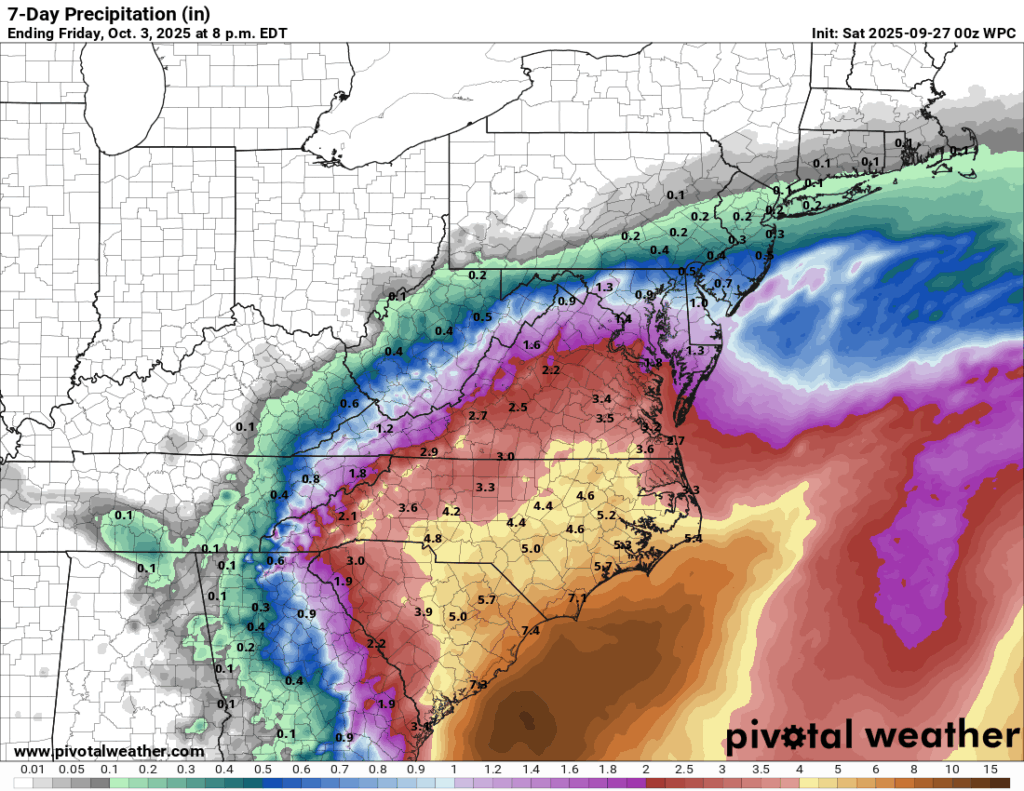
Below the Key Messages graphic, I have put the 7-day precipitation forecast from the Weather Prediction Center, based on what they think is currently the most likely path of the storm. In their scenario, they are expecting a landfall along the South Carolina coast, with the heaviest rain along and to the east of the center track. That would keep most of the rain east of Georgia, although areas along the eastern border could see an inch or two. Any shift in the track would affect where the heaviest rainfall occurred. If the storm stalls along the coast and spins for a few days, the coastal Carolinas could see many inches of rain, similar to Hurricane Matthew in 2016. In Matthew, the eastern counties of Georgia saw some good rain but most of the state was dry due to sinking air on the western side of the hurricane, enhancing the drought that was already occurring there.
By Saturday morning, the storm should become more organized. Eventually a closed low is expected to form and the storm should be named Imelda later on Saturday or on Sunday as it continues to strengthen. Once that happens, we hope the computer models will start to show forecasts that are more consistent with each other, giving us more confidence in what the track will likely be. You can always get updated information, including graphics, at the National Hurricane Center website at https://www.nhc.noaa.gov/. If you live in an area that maybe affected by Imelda, now is a great time to finalize your hurricane preparations before bad weather moves in.