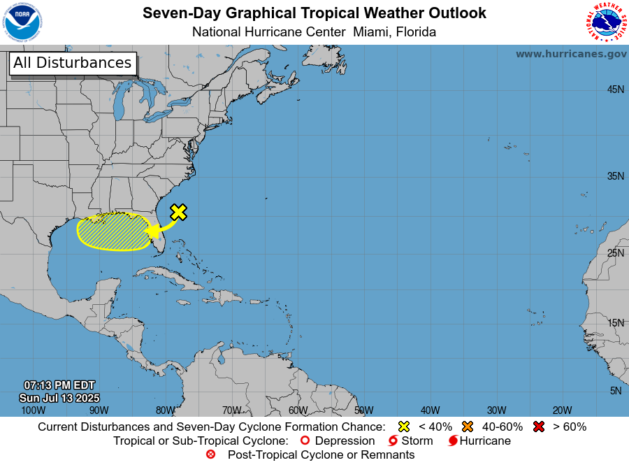
This week a new area of disturbed weather formed in the Atlantic Ocean southeast of our region. It has some thunderstorms but there is no closed low or much of a circulation at this point. The area is expected to move gradually westward over the next few days and will drop quite a bit of rain on the Florida Peninsula as it moves over the land and then out in the northeastern Gulf. Once it hits the Gulf it is expected to continue west. Since the water there is quite warm, there is a 20% chance that the mass of storms could develop some tropical characteristics and even become a weak depression or named storm before it goes ashore or weakens again. The next name on the list is Dexter. The main impact from the stormy area, whether or not it gets named, is copious rainfall in the region where it moves. It would mainly affect northern Florida and then the coastal areas of the Florida Panhandle and Alabama, although parts of Georgia, particularly in the SW, could also see some rain.