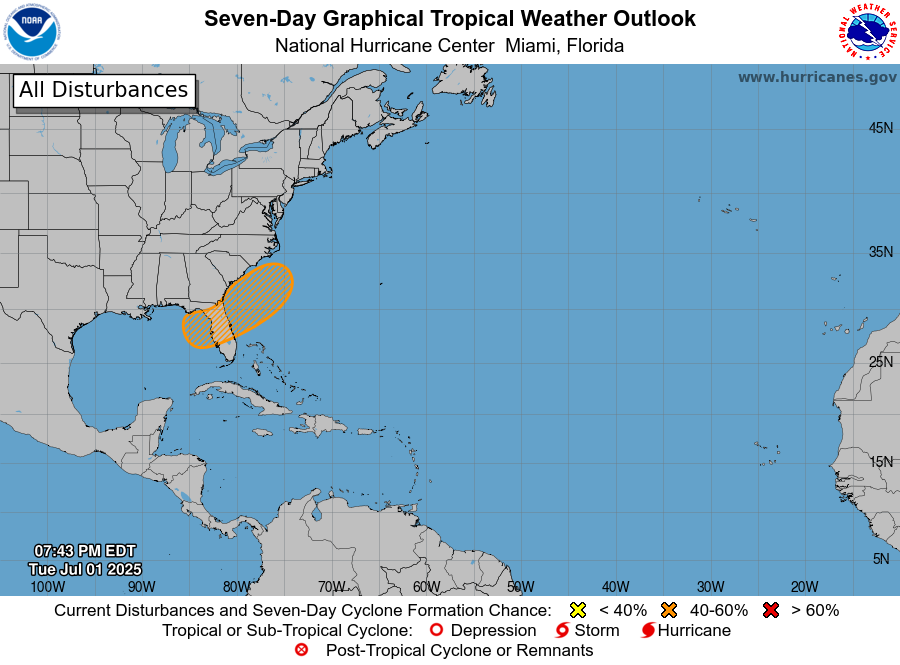
The National Hurricane Center is watching a front that is currently passing through the Southeast dropping rain and causing some scattered severe weather for the next couple of days for the chance of tropical development over the weekend as it stalls in northern Florida. As of tonight, the chance of development over the next week has grown to 40% as the front slows down. The models do not currently agree on whether it will develop in the northeastern Gulf or if it will organize over Florida or the East Coast. The general thought is that it is a little more likely to develop in the Atlantic off the coast of Florida on Saturday or Sunday.
It is not likely to be a strong storm even if it develops a closed circulation and gets named Chantal, but folks who are planning on a holiday weekend along the eastern Gulf Coast, in Florida, or along the East Coast could see some gusty winds and quite a bit of rainy and cloudy conditions. There could also be the chance of rip currents in the ocean, so if you plan to swim in the ocean, make sure you know if rip currents are forecast and how to keep yourself safe from them. I plan to post an update Thursday night which should be sent to those of you who get the daily email on Friday morning.