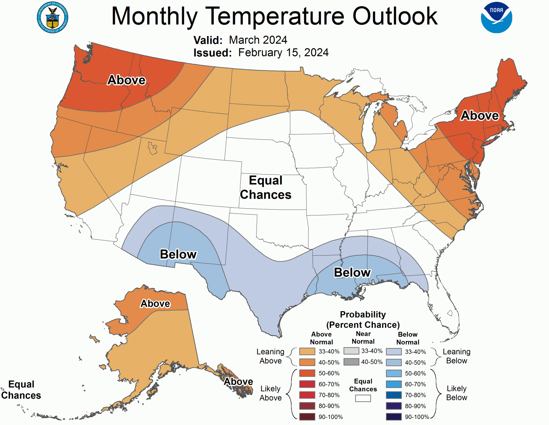
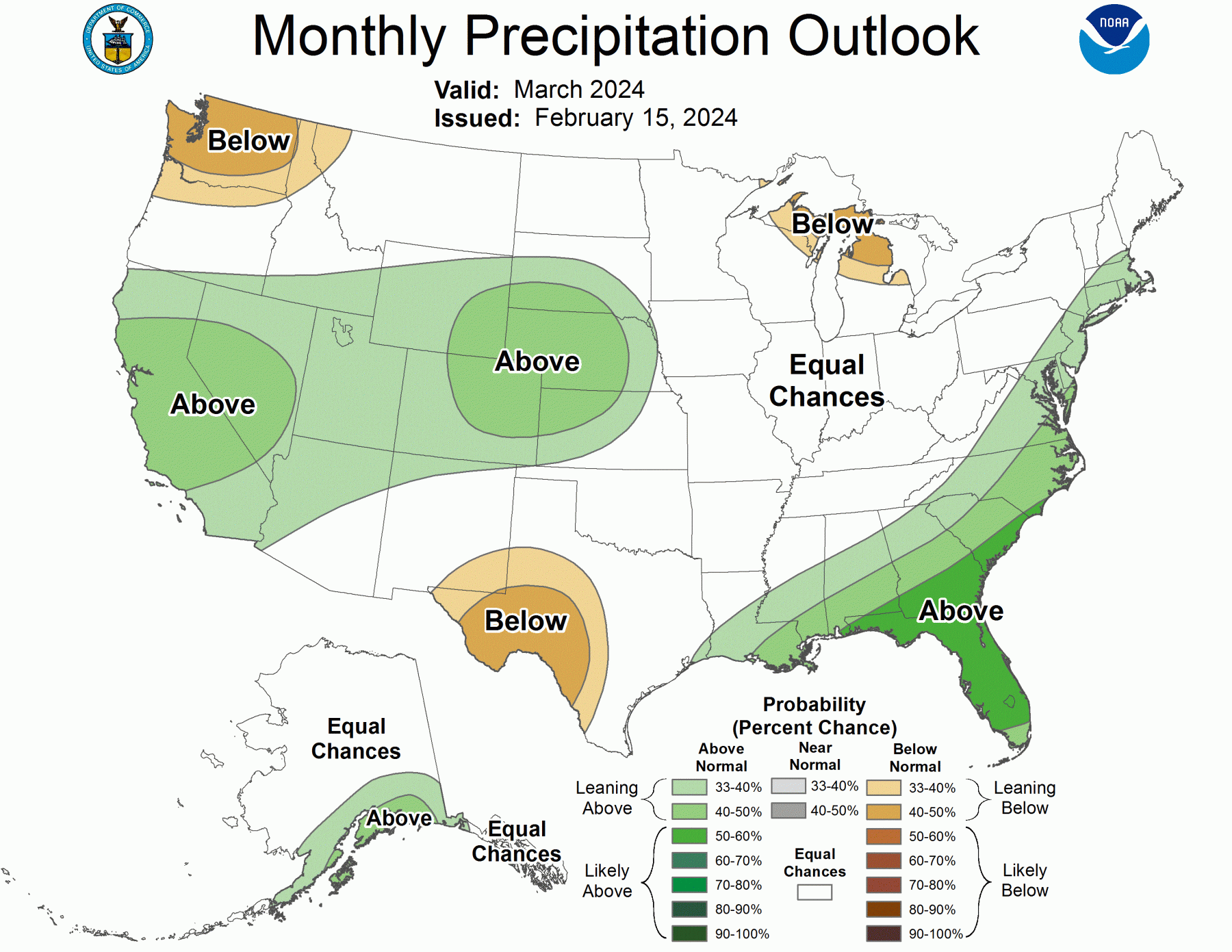
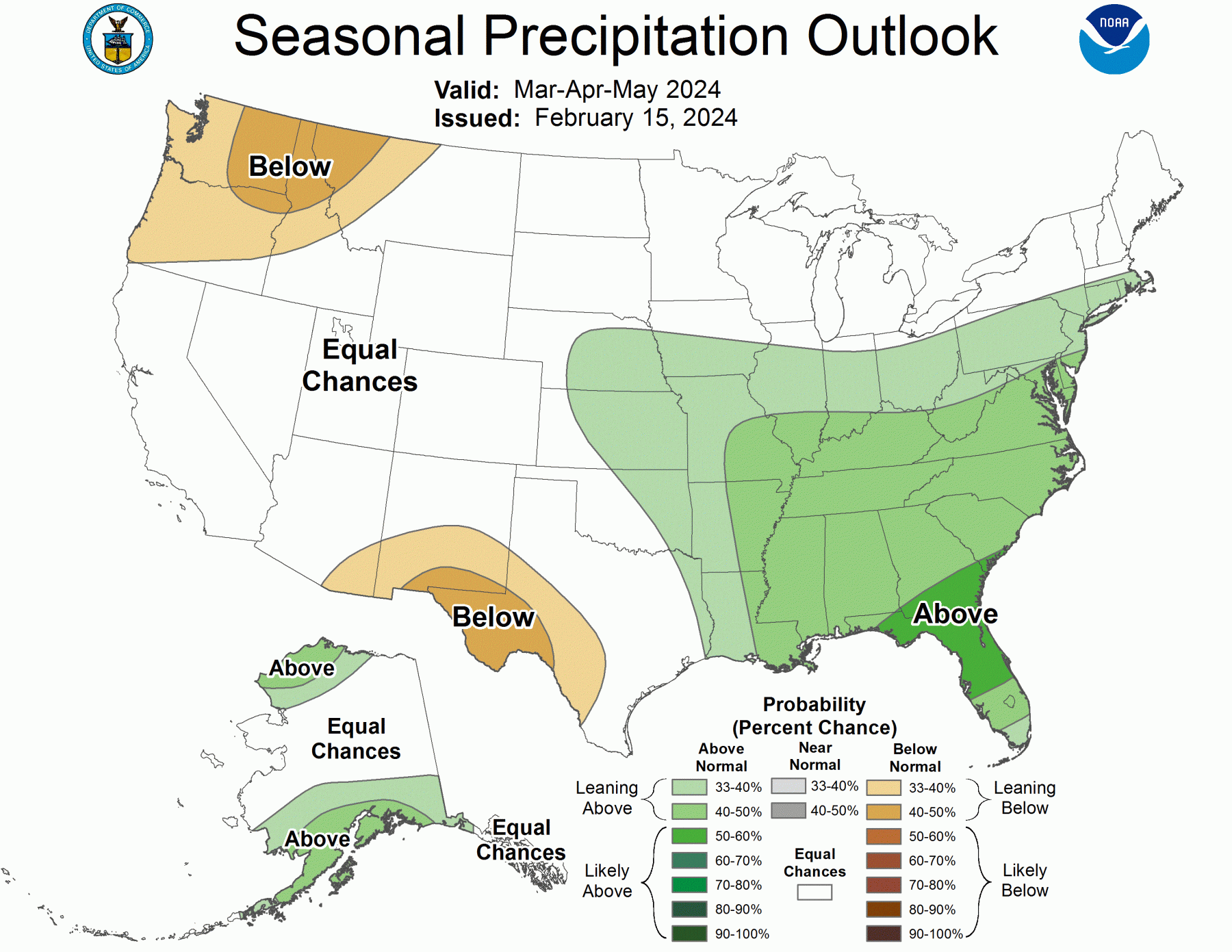
The latest seasonal outlooks for the US were released by NOAA earlier this week. They show that the El Nino pattern of warm north, cool south is likely to continue through at least March. After that, the Southeast may return to values close to normal, or at least the seasonal forecast does not show the climate leaning towards above, below, or near normal. Precipitation across the Southeast is expected to continue to be wetter than normal through the spring season.
You can read a discussion of the temperature prediction from The Weather Channel here. Their maps are slightly different than the NOAA maps. They did not provide an outlook on precipitation.
You can see outlooks for other seasons at https://www.cpc.ncep.noaa.gov/products/predictions/90day/. It is not surprising that the outlook for next winter is already showing the typical pattern of a La Nina with warmer and drier conditions expected for most of the Southeast.