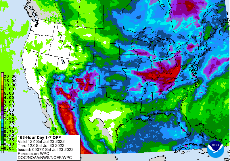
The latest 7-day QPF map shows that rainfall amounts this week should be relatively light. The heaviest amounts will be in the Southern Appalachians, along the Carolina coast, and in the Florida peninsula. Some scattered showers may occur anywhere in the region, but they are not expected to amount to much. Meanwhile, the tropics remain quiet as they often do in mid-July, and no immediate development is likely, although some of the long-range models show increased activity off the west coast of Africa at the far end of the prediction window.