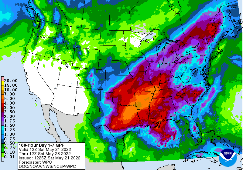
The pattern shift that is occurring this weekend will bring an increased chance of rain to most of the region this week. The coastal areas of the Florida Peninsula will be the driest, with amounts increasing as you move to the north and west. Most places should see an inch or more, but it will be typical summer showers so the pattern will be spotty, with hit or miss storms through the week. There could be a break next weekend before rain returns. After a brief flurry of activity in the GFS models hinting at a possible tropical storm, the tropics are now looking quiet again, meaning that it is unlikely we will get a named storm in May this year. With the clouds and rain come cooler conditions, which should be a relief to people who do not like hot weather.