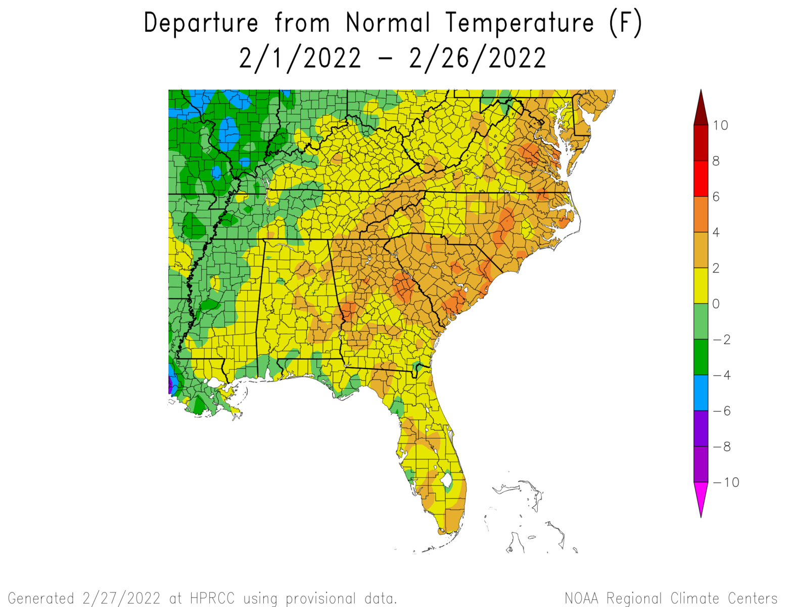
With the end of the month approaching, here is a quick look at how the month is ending up. According to the maps from the High Plains Regional Climate Center, February 2022 is warmer across almost all of the region, typical of a La Nina winter. Most of the region other than Alabama and the areas near the mountains was also drier than normal, also typical of La Nina. This looks different than 2021 when the Sudden Stratospheric Warming brought a cold outbreak to the central US that also affected our temperatures. The warm and dry conditions this year are contributing to the expansion of dry conditions and moderate drought we saw in the last Drought Monitor last week, and further expansion is likely. It is interesting to note that the daytime high temperatures are more above normal than the overnight lows, which reflect the very dry conditions that allow the range of daily temperature to be greater than it is in wetter conditions (like last summer).