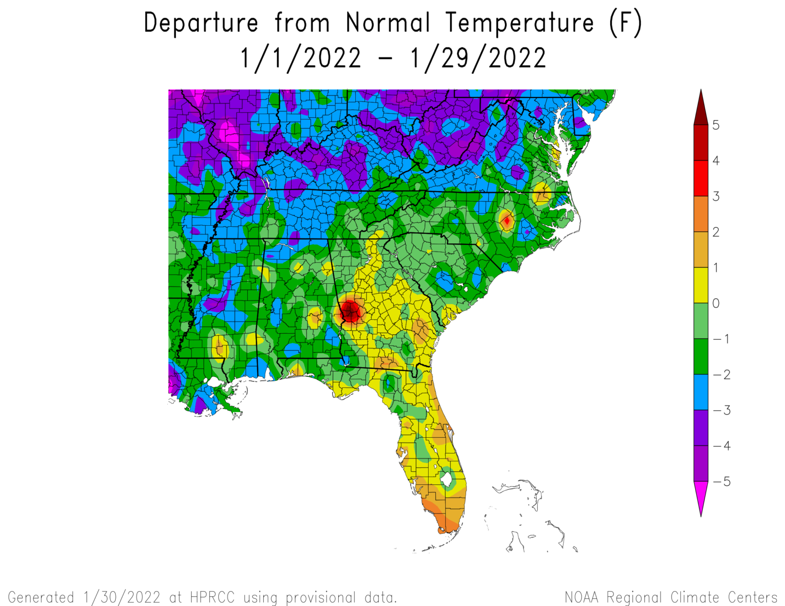
With just a couple of days left in the month, it’s time to take a look at January’s preliminary climate statistics. While most of the Southeast has been cooler than normal, Georgia and Florida will end up warmer than normal. This has contributed to their vulnerability to frost, since many plants are almost a month ahead of their normal bloom date. You might wonder about some of the bullseyes in the map. Most likely these are bad data points that have not been corrected yet by quality control, especially on temperature maps, since temperature generally varies quite smoothly across the region, while precipitation can be more variable due to the effects of individual storms.
Precipitation in eastern North Carolina, South Carolina, and Virginia have helped reduce drought conditions there, but Georgia, Alabama, and Florida have generally seen drier than normal conditions except for a wet streak in southern Georgia stretching into the Florida Panhandle.
Note that for the period since October, the region has been warmer and drier than normal. This is consistent with the La Nina pattern that is occurring now.