The content on this page is retained only for recordkeeping, historical reference, or research. These materials are preserved in their original form and may not meet current WCAG 2.1 AA accessibility standards.
These archived materials are not required to be remediated. However, we remain committed to equitable access. If you need an accessible version of any archived item to participate in our current programs and services, we will provide one when feasible upon request at caesweb@uga.edu.
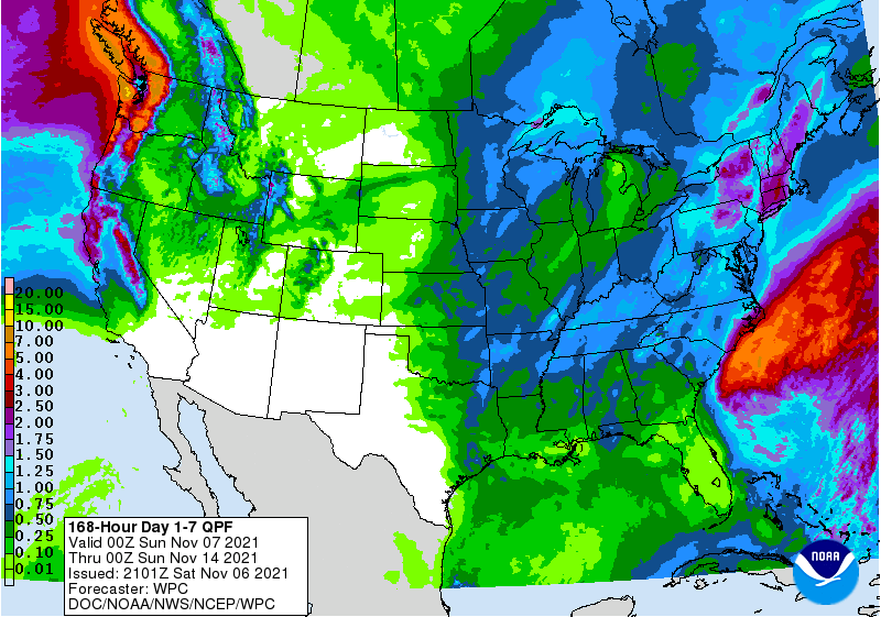
The 7-day QPF map shows that rain should persist along the East Coast for the next day or two from the low that is moving along the coast today. By Tuesday night it should be dry across the region and a bit warmer. That will continue until later on Thursday when the next front begins to move into Alabama. This front should bring more rain next weekend along with cooler temperatures and the potential for some frost and freezing temperatures at higher elevations and latitudes.