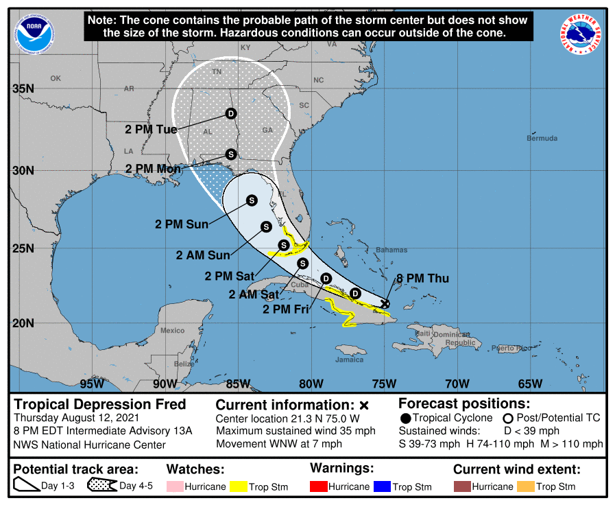
Tropical Storm (and now Depression) Fred got its feet cut out from under it by the mountains of Hispaniola today and became very disorganized. The National Hurricane Center is predicting that it will gain sufficient strength over the Gulf to regain its strength as a weak tropical storm and move north to the west of the Florida peninsula, making landfall along the northern Gulf Coast.
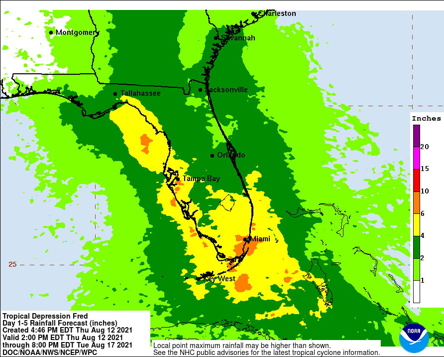
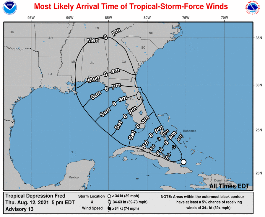
The primary impacts from Fred will be some gusty winds and a bunch of rain stretching north along the Florida peninsula and south to north through Georgia, with several inches expected along and to the right of the path of the center. The wet conditions combined with the winds, even though they won’t be very strong, are likely to bring down trees and cause power outages, so make sure you have ways to access power if you need it for pumping or dairy, for example. Note that the rainfall map below only goes through Tuesday evening and additional rainfall is likely after that in north Georgia and into the Carolinas. To prepare for the storm, you should also remove objects that could become airborne and cause damage, check trees for dangerous limbs, and move animals and equipment away from areas prone to flooding.