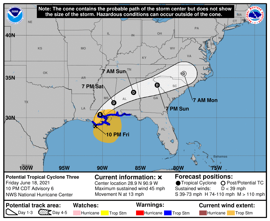
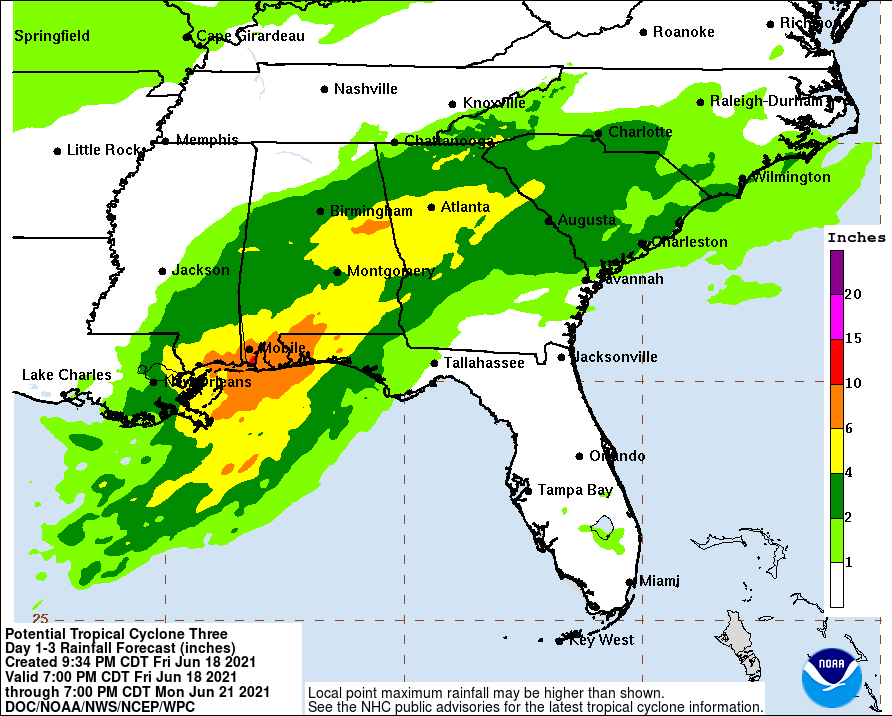
Update: As of 4 am, this was named TS Claudette. The National Hurricane Center is still watching Potential Tropical Cyclone Three to see if it organizes enough to become a named storm before or soon after it makes landfall sometime overnight. If you read this in the morning, then you will know what happened! The most recent forecasts move the track a little to the right of the old one, which means that the heaviest rain band is now farther south and is likely to bring 4-6 inches to Atlanta and Athens, among other places. Rain is already falling along the northern Gulf Coast, with some lighter showers in central Georgia tonight. Rain will move northward overnight and will cover a lot of Alabama and Georgia by Saturday night. The center of circulation is expected to move through North Georgia on Sunday before heading to the northeast into South and North Carolina as a post-tropical depression.