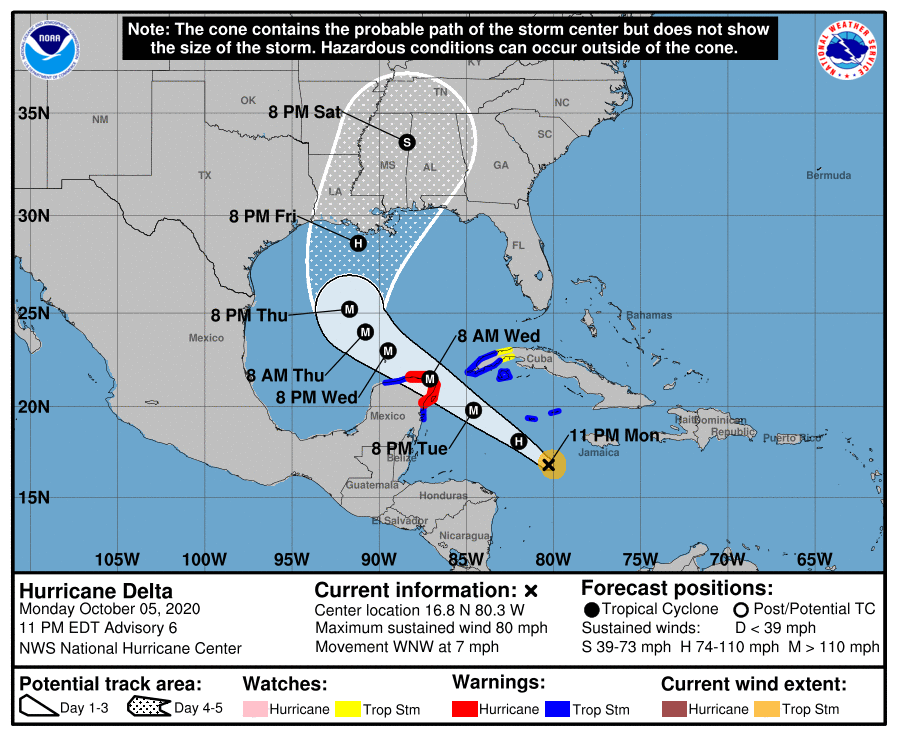
This morning Delta became a tropical storm, but by this evening it was already a hurricane due to rapid pressure falls in the center of circulation. The latest forecast now indicates that Delta is likely to be a major hurricane as it crosses the Gulf of Mexico, although it is expected to weaken before it makes landfall Friday evening. Impacts for the Southeast remain the same, with the biggest effects in Alabama, western Georgia and the western end of the Florida Panhandle. A stronger storm means that storm surge along the coast is likely to be higher than it would be if the storm were weaker. By the time it makes landfall it should be moving at a pretty good clip, which will reduce the amount of rainfall at any one location. You can get updated information from the National Hurricane Center. Note that Delta developed six weeks earlier than the only other time we have had a storm Delta back in 2005, another very active year.