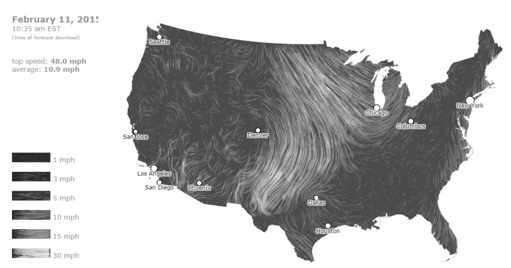
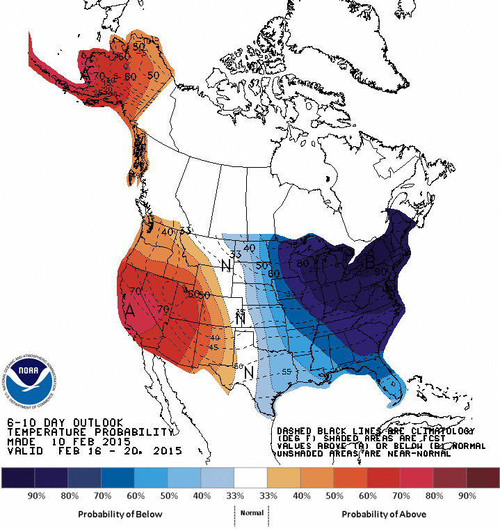
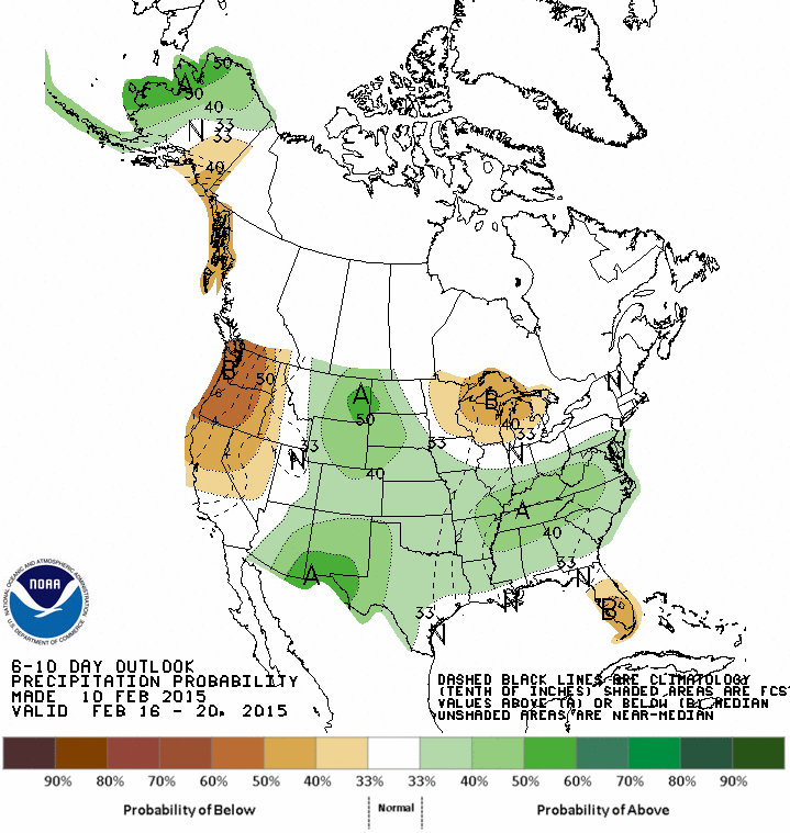
After some nice warm and sunny days, a blast of winter air will be returning to the Southeast by Thursday and will last for several days. The wind map below shows the push of frigid air into the region from Canada. You can see it in action at https://hint.fm/wind/ or the full global version at https://earth.nullschool.net/. Temperatures for the next ten days are expected to be significantly below normal. Coupled with precipitation chances somewhat above normal, and we may see the chance of some wintry precipitation in the next week or so, although it is too early to say with any certainty. If you have outdoor activities planned for the middle of next week you will want to watch forecasts for updated information.