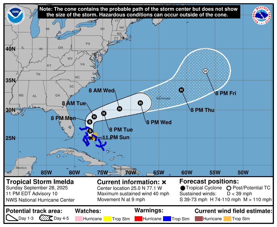
It’s been an exciting day for the tropics. At 2 pm today Tropical Depression 9 became Tropical Storm Imelda as expected when the wind speed increased to tropical storm force. It is still headed north parallel to the Florida coast and is expected to continue to move in that direction for the next day. At the same Hurricane Humberto became an extremely strong category 5 hurricane before it weakened slightly to category 4 status.
In what is an unprecedented interaction between the two hurricanes, the strong circulation around Humberto appears to be affecting the predicted track of Imelda. Over the last day and a half, the forecast track has shifted dramatically from making landfall in South Carolina to taking a hard right turn to the east away from land later this week long before it can get close to the East Coast. The result is a significant reduction of impacts in the Southeast, with almost no chance of significant winds away from the coast and practically no rain in Georgia except along the immediate coast, although there could be some heavier rain in the Carolinas. There will still be some high waves and rip currents along the coast but very few other significant impacts.
The hurricane experts I follow say that this is the first time they can recall seeing this kind of interaction between two hurricanes. Occasionally two hurricanes will whirl around each other if they get close enough to interact, but not to this extent. So this is something that has never been seen in recorded history before as far as we can tell.
The only downside of this situation is that there is likely to be little rain in Georgia, which means that dry conditions will probably get worse this week since there is little chance of rain for at least the next week except for some shower activity.