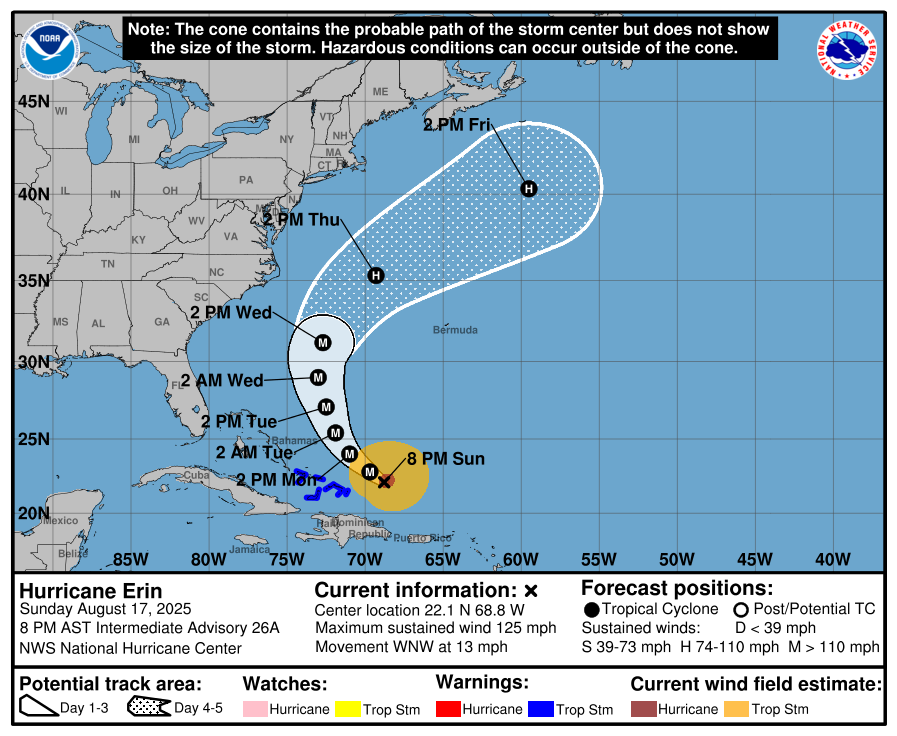
It’s that time of year. The tropics are becoming more active and every wave coming off of Africa has to be watched for signs of development. Today we are watching Major Hurricane Erin as it moves NW on a path that is expected to curve north and then NE off the East Coast between Bermuda on the east and the Bahamas on the west. While it is not expected to make landfall in the Southeast, we can expect some impacts along the coast. Since Erin is a strong storm, it will be generating high waves and rip currents along the coast, so if you have a beach trip planned, make sure you follow the warning flags and stay out of the water if necessary. If Erin follows the west side of the cone, we are likely to see some strong winds on the NC Outer Banks as Erin gets close on Wednesday. Erin has already brought gusty winds, high waves, and a lot of rain to the US Virgin Islands and Puerto Rico.
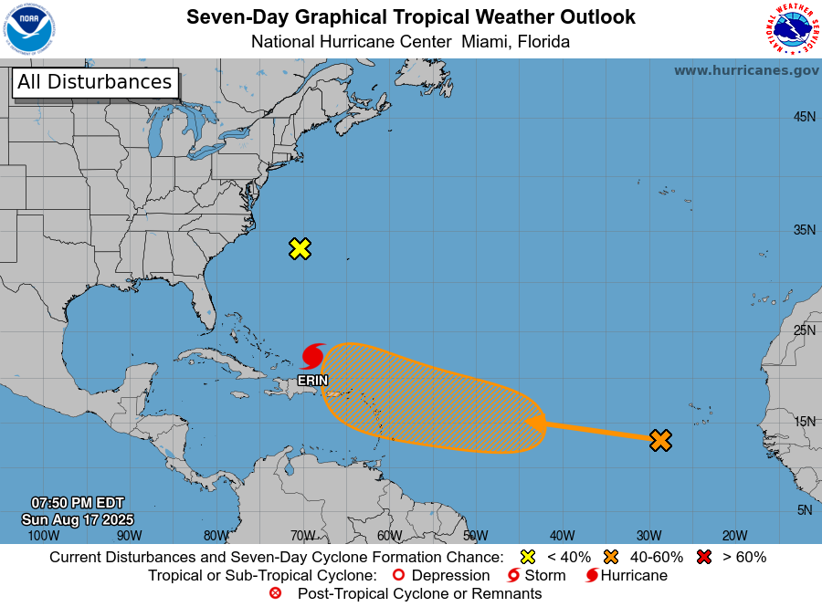
The National Hurricane Center is now showing another wave coming off of Africa that has a 40% chance of developing into a named storm in the next seven days. The chance of it getting close enough to the Southeast to affect us is not zero but there is so much uncertainty at this point that we cannot say for certain whether it will follow Erin’s path and recurve to the NE or if it will get closer to the Southeast or even enter the Gulf. If it does develop where expected, we should have at least a week before it gets close enough to cause any impacts if it does follow a path that affects us, so at this point, it mostly bears watching. Don’t let social media posts of a single model run scare you–they have no skill until a low pressure center develops and often change drastically between one run and the next. Now is a great time to get your hurricane plans in place if you have not already done it, though.
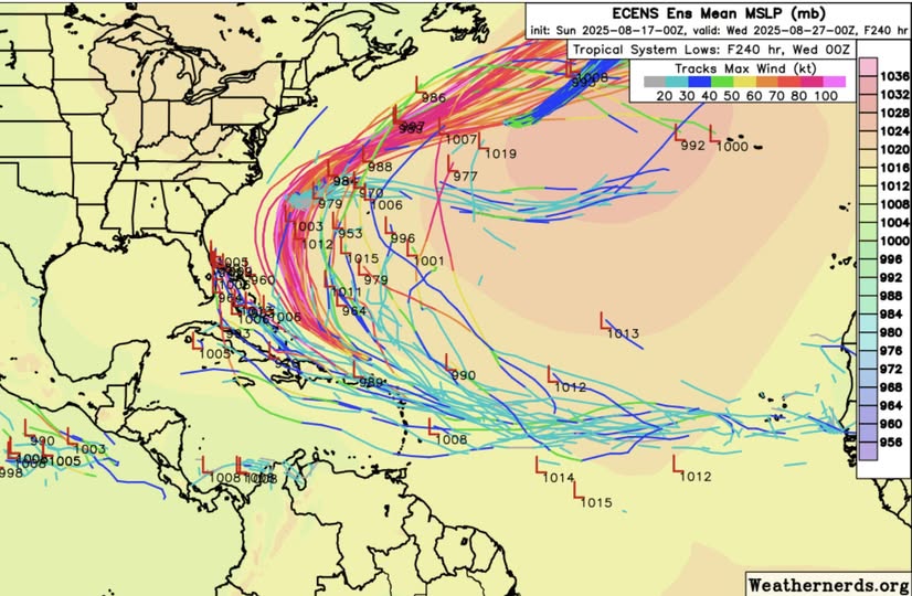
Where will that new storm go? If we look at the spread of model results from the European model below, you can see both the paths from Erin plus some new paths from the potential new storm. Many of those indicate a path similar to Erin, although perhaps a little farther to the west, but a few come close to the east coast of Florida and a couple into the Gulf, so we cannot completely rule those out at this point, although they are unlikely. A lot will depend on how much cold water is brought up to the ocean surface from Erin as well as how the circulation of Erin interacts with the developing low, and that cannot be determined yet.