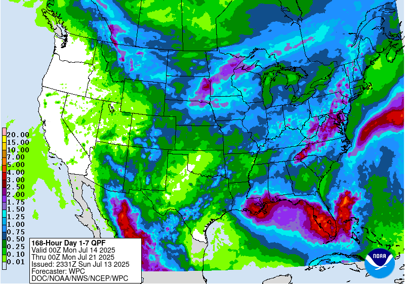
The latest 7-day precipitation map shows that the heaviest rain this week will fall in northern Florida and along the Appalachian Mountains and north into a good bit of Virginia this week. The Florida rainfall is associated with a disturbance that is currently off the East Coast that is expected to move westward over the next few days into the Northern Gulf. Once it gets there, there is a chance of it developing into a named storm (see separate post) but it will mainly be a heavy rain producer for the area near it. That will include the far southern edges of Georgia and Alabama as well as the Florida Panhandle. Showers will also occur over the mountains on an almost daily basis. Areas in between should see widely scattered showers that will be hit or miss. The driest period will be late in the week.