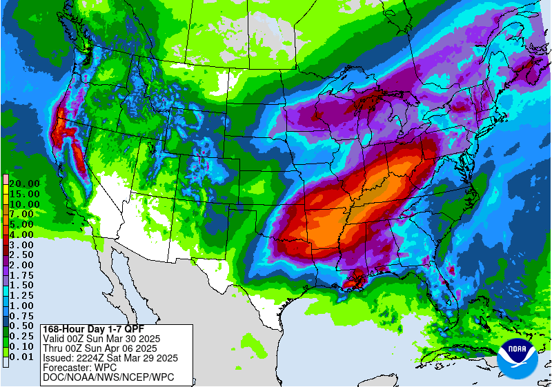
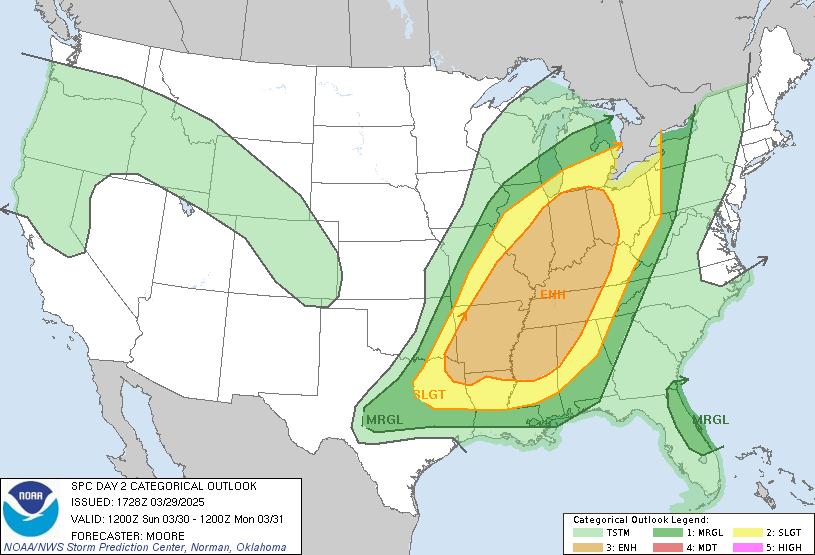
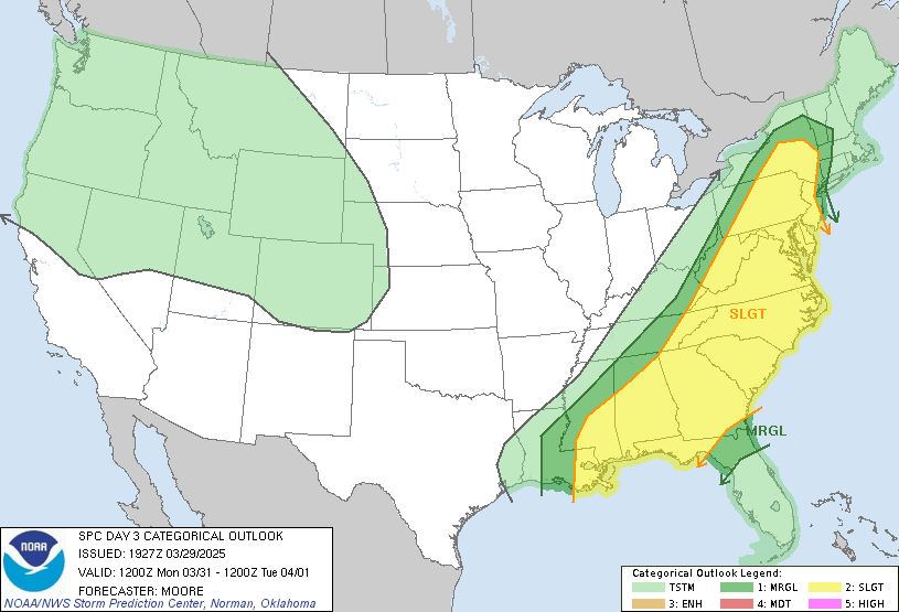
The latest 7-day QPF map shows that most of the rain in the next week will fall over Sunday and Monday as two lines of storms move through the area on Sunday and Monday. Some scattered severe weather is expected from the storms, although there will be more to our northwest where the most suitable weather conditions are expected to occur. Once that storm activity passes to the east, it will be mostly dry, although there is a chance of some light showers in southern parts of the region on Tuesday night into Wednesday morning. Another round of rain is expected next week Sunday, followed by another week of mostly cool and dry weather, but that forecast is subject to change as we get closer. Weeks 3 and 4 have a better chance of normal to dry conditions and warmer than normal temperatures.