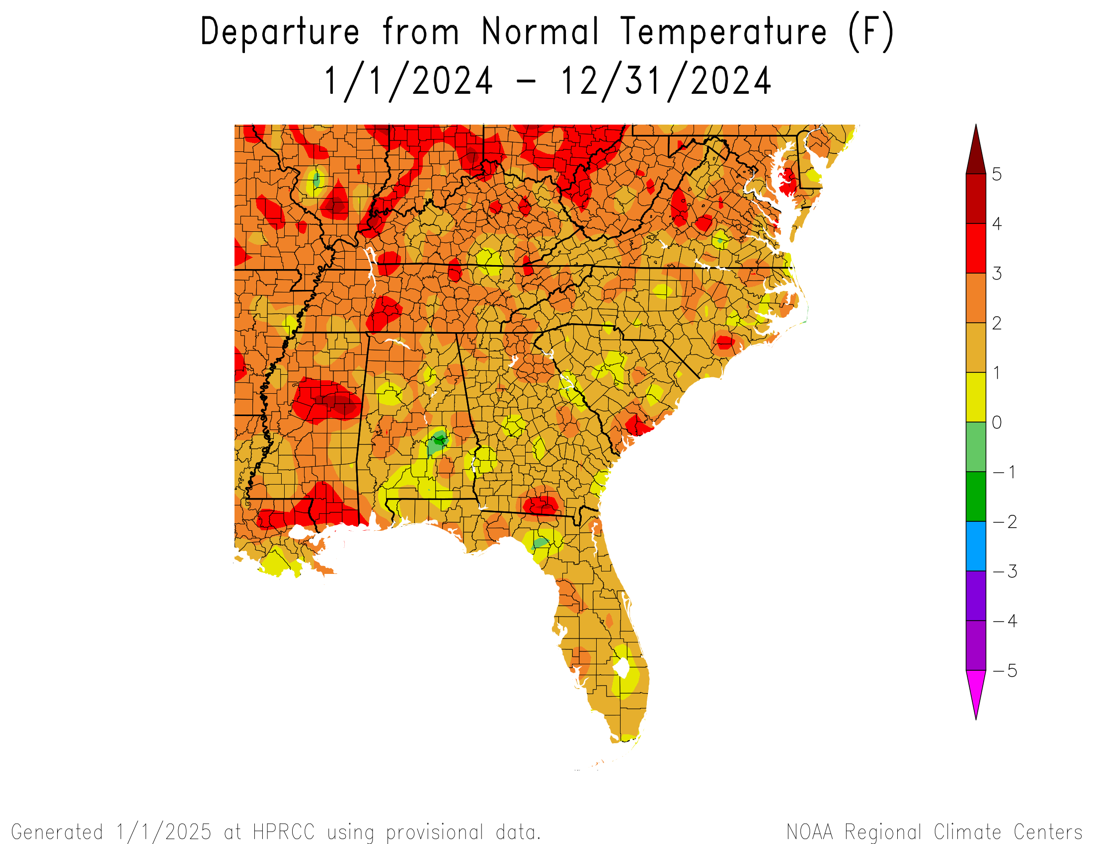
While a lot of the statistics for the 2024 climate are still being compiled and quality-controlled, we can take a quick look at the preliminary yearly statistics using the High Plains Regional Climate Center’s online maps at https://hprcc.unl.edu/maps.php?maps=ACISClimateMaps. They show that overall the Southeast was generally 1-2 degrees warmer than normal, with the highest deviations to the north and west. In fact, on the national map the northern Great Lakes show the highest departures of any part of the continental United States.
The annual precipitation departure was well above normal in many parts of the region. However, it is interesting to note that most of the positive departures are due to the occurrences of tropical storms and hurricanes across the region, including Debby, Francine, Helene, Milton, and the remains of Rafael as well as a Potential Tropical Storm that did not become a named storm before making landfall in the Carolinas. Rainfall totals varied significantly from one month to the next over the growing season, allowing rapid onset drought to develop several times between tropical events. This caused significant problems for farmers since the rainfall from the tropical systems fell so hard that very little moisture soaked into the grounds except in low-lying areas, where it suffocated plant roots. In this case, the annual average rainfall does not do a good job of capturing the problems that farmers had with the impacts of the rain on their crops in this past growing season.