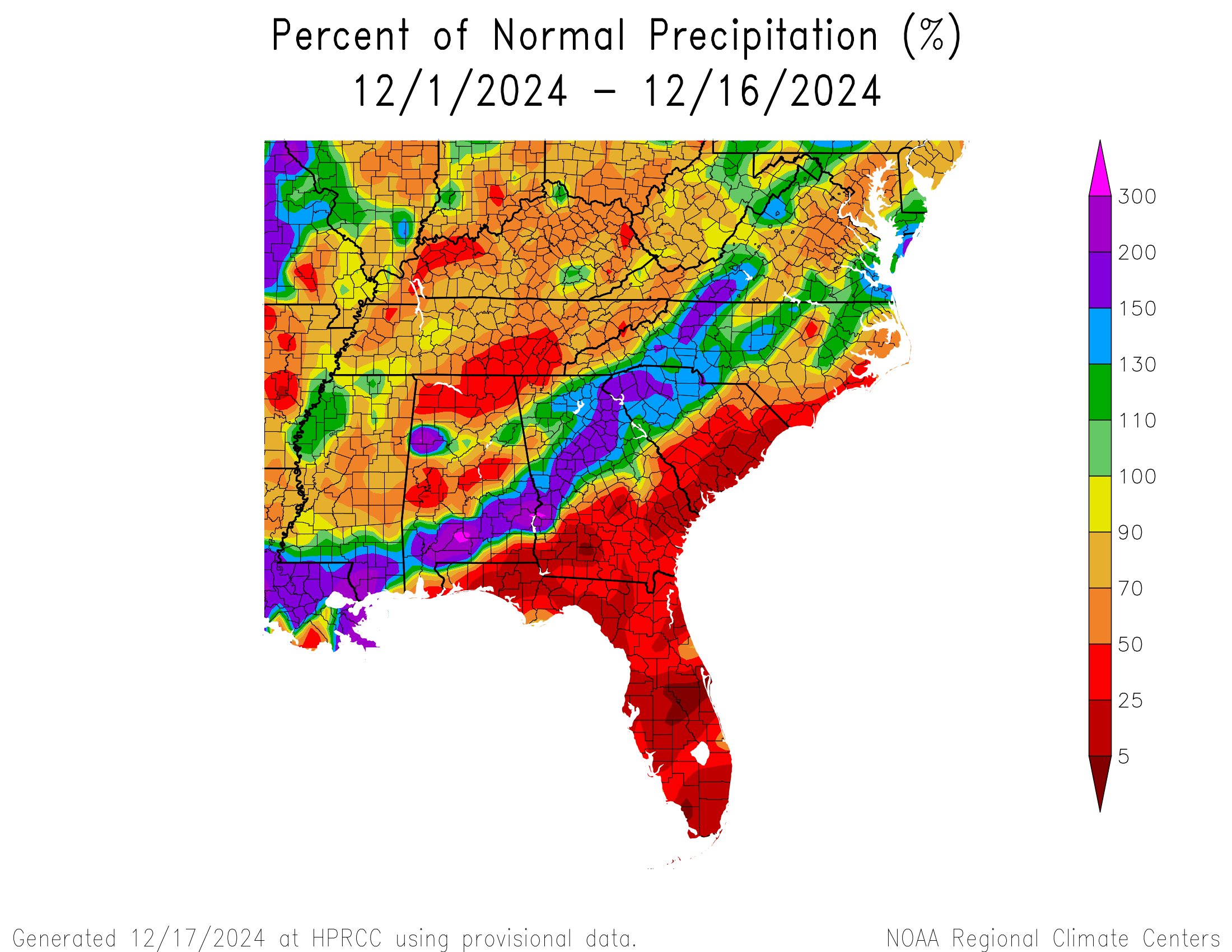
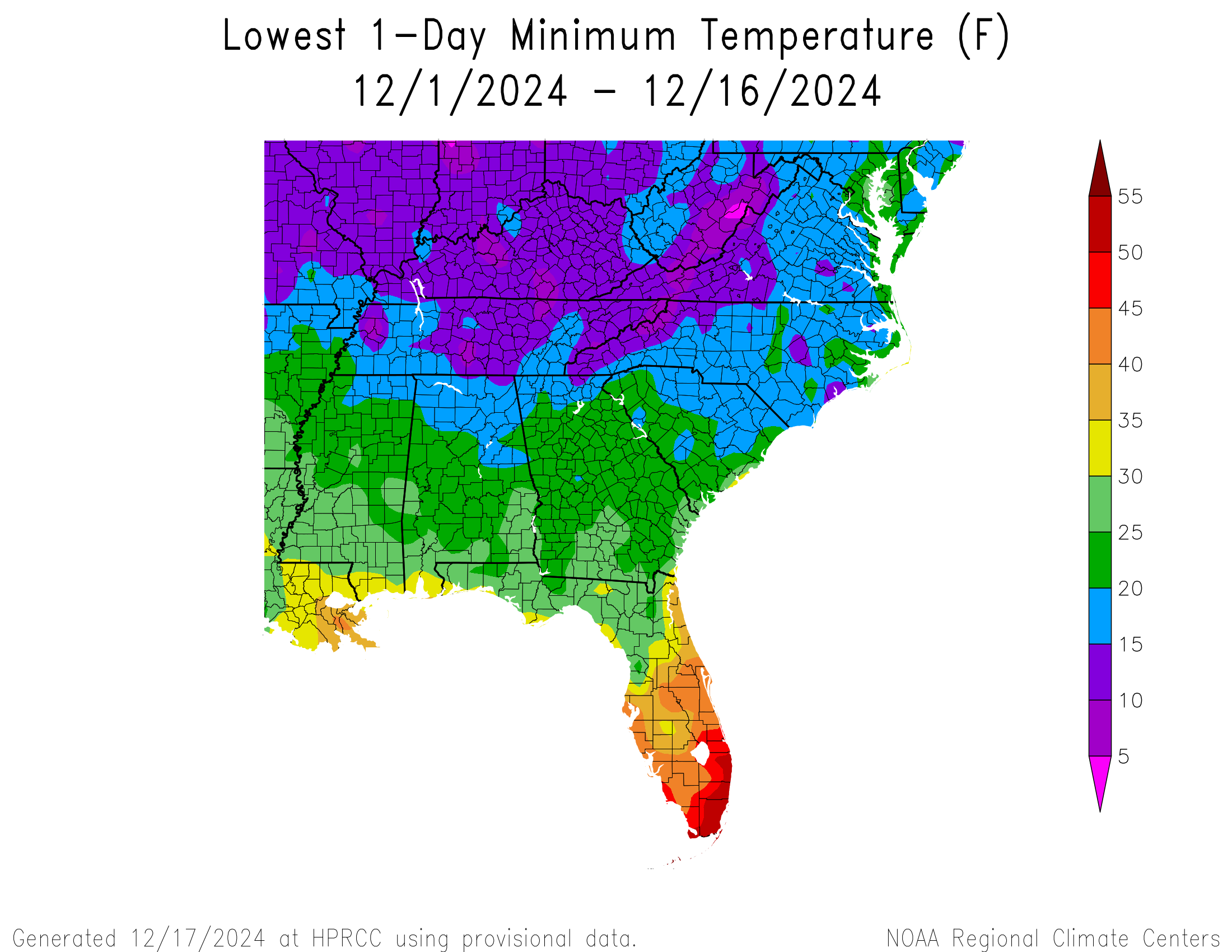
We are halfway through the month of December, and so far the region has been cooler than normal across almost the entire area. We are currently experiencing warmer weather but another cold front is expected to move through in a day or two, bringing another short-lived blast of cold air before things really warm up between Christmas and New Year’s. The cold conditions will add to the accumulation of chill hours needed by fruit to set a good bloom next spring. Rainfall conditions have been varied, with a streak of wet conditions draped through the Southeast while the rest of the region has had little to no rain since December began. The map showing the coldest temperature for the last two weeks shows that everywhere in the region south to central Florida has experienced a freeze. The only areas that have been missed are a few areas right along the coast and in central and southern Florida as well as the northeast coast.