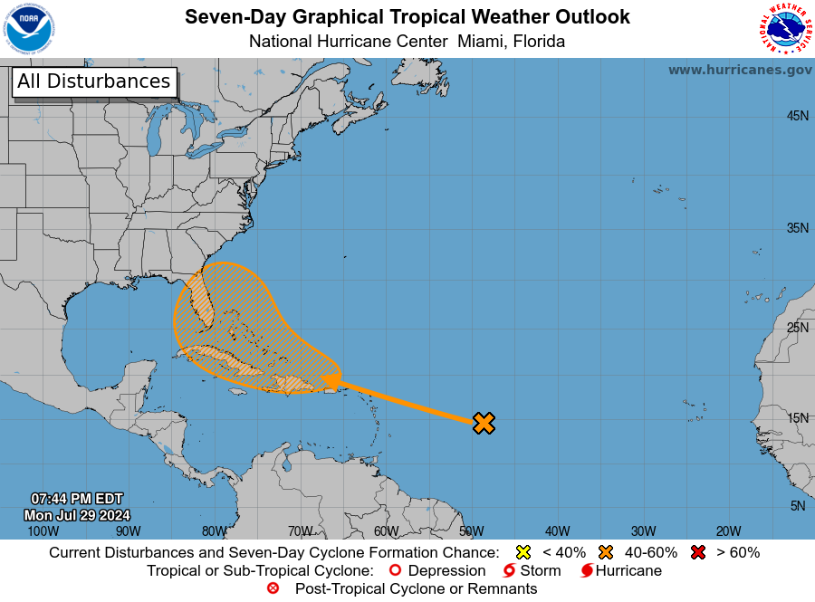
The National Hurricane Center is continuing to watch a pair of tropical waves moving west across the Atlantic for potential development later this week. The waves are expected to interact in an area of low Saharan dust and could form a named storm in early August as the season starts to ramp up. Since there is no defined circulation yet, computer models have limited success in showing where the storm, if it forms, is likely to form. A number of the computer solutions show it curving north before it gets to the USA, but there are some model runs that suggest it could move farther west and could impact either the East Coast or move farther west. There are no immediate concerns but it is something to watch if you live in the Southeast. This storm is more likely to impact us than Beryl did earlier this summer but it is still a long ways away from determining what impacts, if any, there will be.
