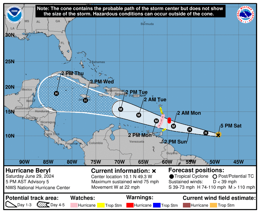
As of 5 pm on Saturday, TS Beryl was upgraded to a hurricane by the National Hurricane Center. Beryl’s vertical structure is almost perfectly stacked with no wind shear and it is over an area with very warm ocean temperatures, so it is expected to become a major hurricane in the next couple of days before it starts moving into less favorable conditions. At this time there is no indication that there will be any impacts in the Southeast other than some rain and heavy waves near Puerto Rico. There is another area of interest following Beryl along a similar path, but so far it does not look of concern either as long as we are under a strong ridge of high pressure. The fact that this is one of the earliest storms to ever develop so far east in the Atlantic reinforces the idea that it will be a very active year, and you should be getting prepared now. See my related post providing important information from the Florida Land Steward Newsletter on Friday.