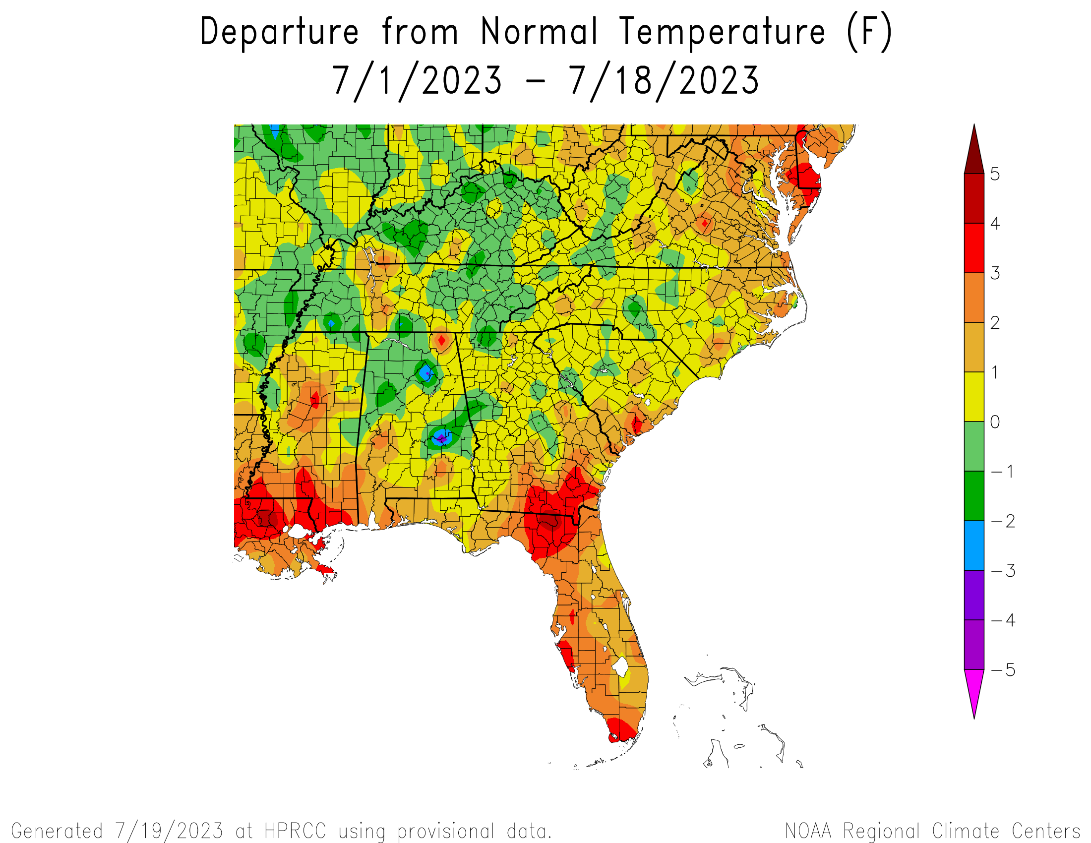
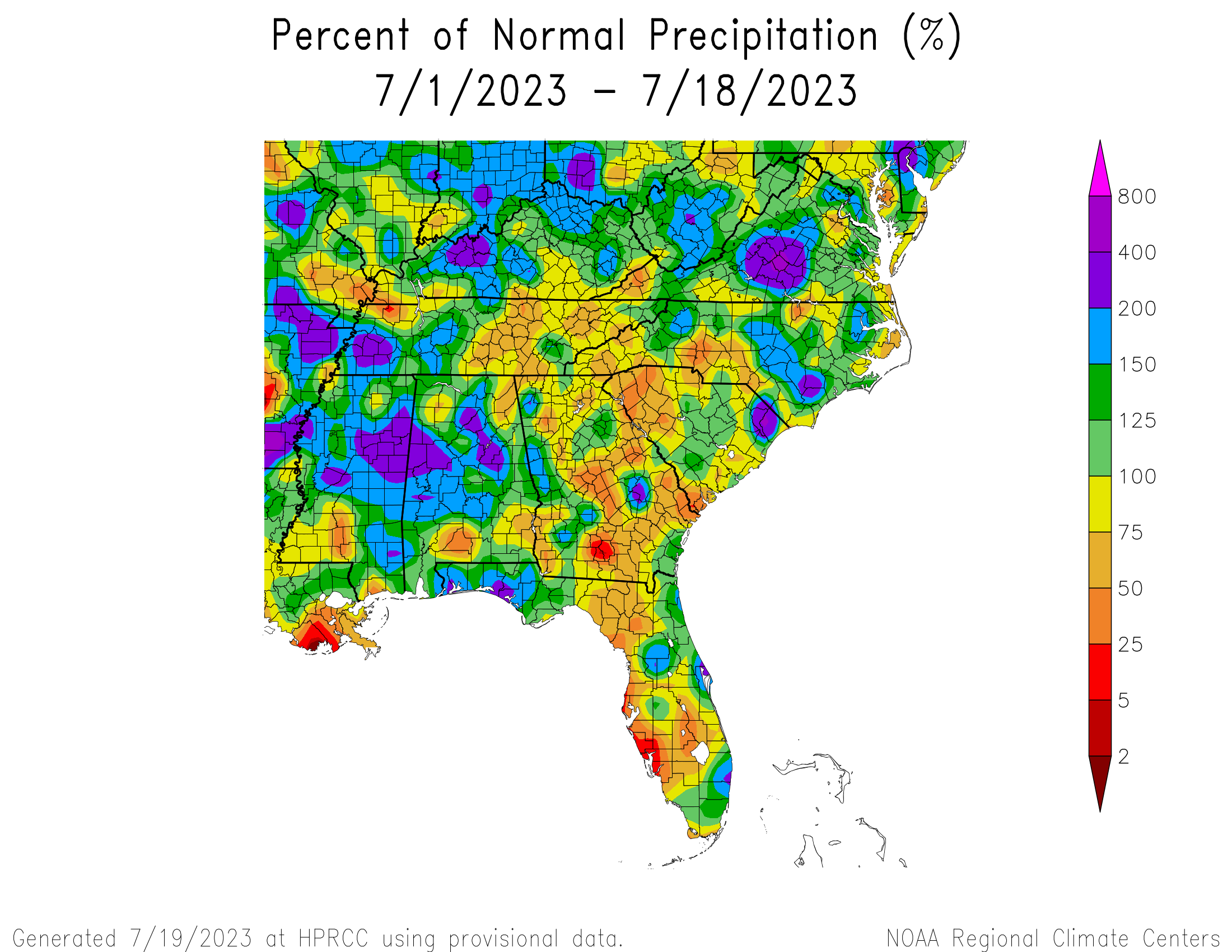
We are just past halfway through July, so let’s take a look at the climate for the month to date. The temperature is generally quite warm, with most parts of the region experiencing temperatures that are higher than normal. This situation is likely to continue until the end of July, so we can expect to see a monthly average that could reach near record levels in some areas. In many cities in Florida, according to the SERCC Climate Perspectives tool, it is already the warmest July on record for the month to date. Since the Climate Prediction Center indicates a high chance of above-normal temperatures will continue through the end of the month, that means more stations could reach near-record average monthly temperatures. The precipitation percent of normal for the region is quite variable, as we expect when convective rainfall dominates the pattern, but Georgia and Florida are generally the driest area while Alabama and Virginia are the wettest. The forecast for the rest of the month shows that is likely to remain fairly dry due to the persistent dome of high pressure, so precipitation percentages are likely to continue to decline.
The tropics are quiet right now, so we don’t expect any relief from tropical storms in the next few weeks, although there is one area in the Main Development Region of the Atlantic that has a 20 percent chance of developing in the next week. It is still a long ways from land so at this point all we can do is watch it for signs of development.