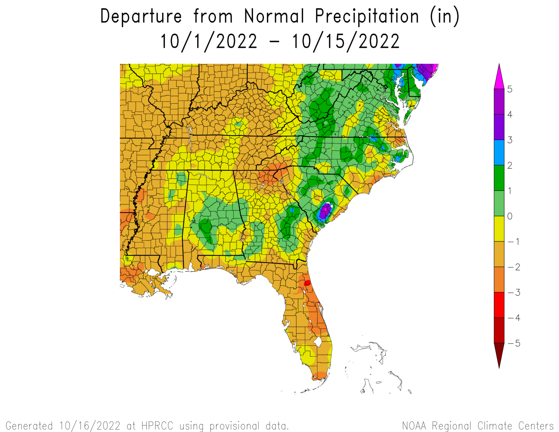
Since we are halfway through October, let’s take a quick look at the month so far. The temperature has been cooler than normal across the region, but especially in Alabama, North Carolina and Virginia. If you go to the High Plains Regional Climate center ACIS maps at https://hprcc.unl.edu/maps.php?maps=ACISClimateMaps, you can see that daytime high temperatures in many parts of the region are warmer than normal, but overnight lows have been consistently cooler than normal. This results in a larger than average range of daily temperatures that is related in part to recent dryness. The precipitation map shows that quite a bit of the region other than Florida has seen little rain this month, but if you look at the last 7 days, you can see that early in the month the rainfall was dominated by the remains of Hurricane Ian that was spinning near the East Coast and dropping rain on North Carolina and Virginia (the rest of Ian’s rain fell in late September as it crossed Florida and made another landfall in South Carolina), while the last week had a lot of rain in Alabama, Georgia, and southern South Carolina from rainfall associated with a front in the area. With dry conditions expected for the next week, those wet areas will shrink back towards normal.