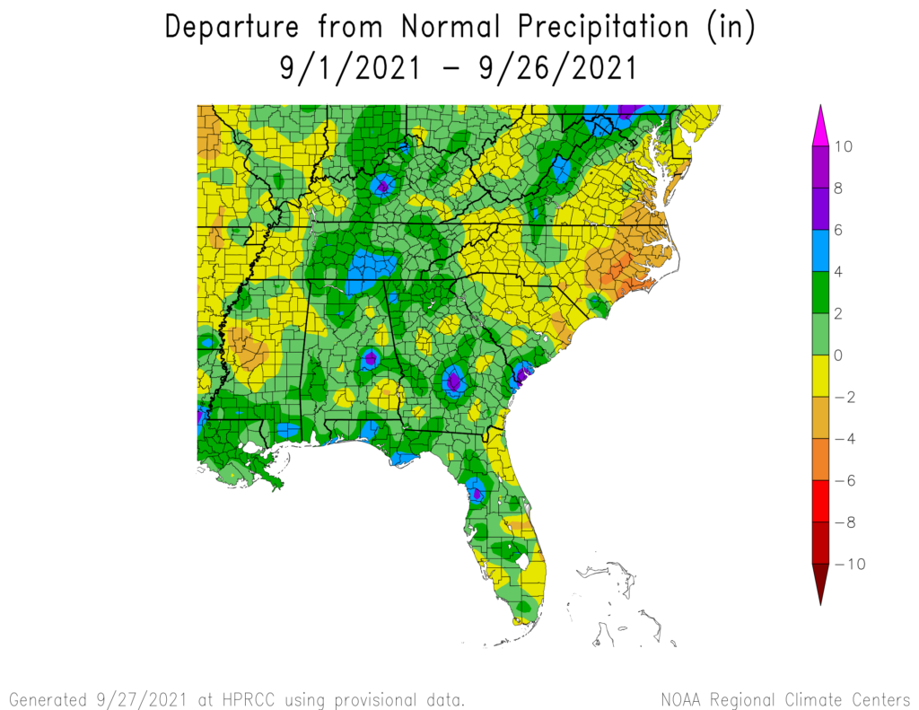
With just a few days to go in the end of the month, the maps show that most of the region has received more rain than normal. The wet areas are also cooler than normal, most likely due to the cloud cover and difficulty heating all that water. This last week of dry conditions will push the final totals back towards normal since we won’t see much if any rain before the end of September, and while this week started cool, things are warming up again. Eastern North and South Carolina and Virginia were missed by a lot of the rain and are quite dry now, with abnormally dry conditions expanding there.