I’ve busy with two conferences this week, including the UGA Ext Emergency Prep Small Team Members group (hello, new subscribers!) so have not posted much. Here’s a brief update on the tropics for planning purposes.
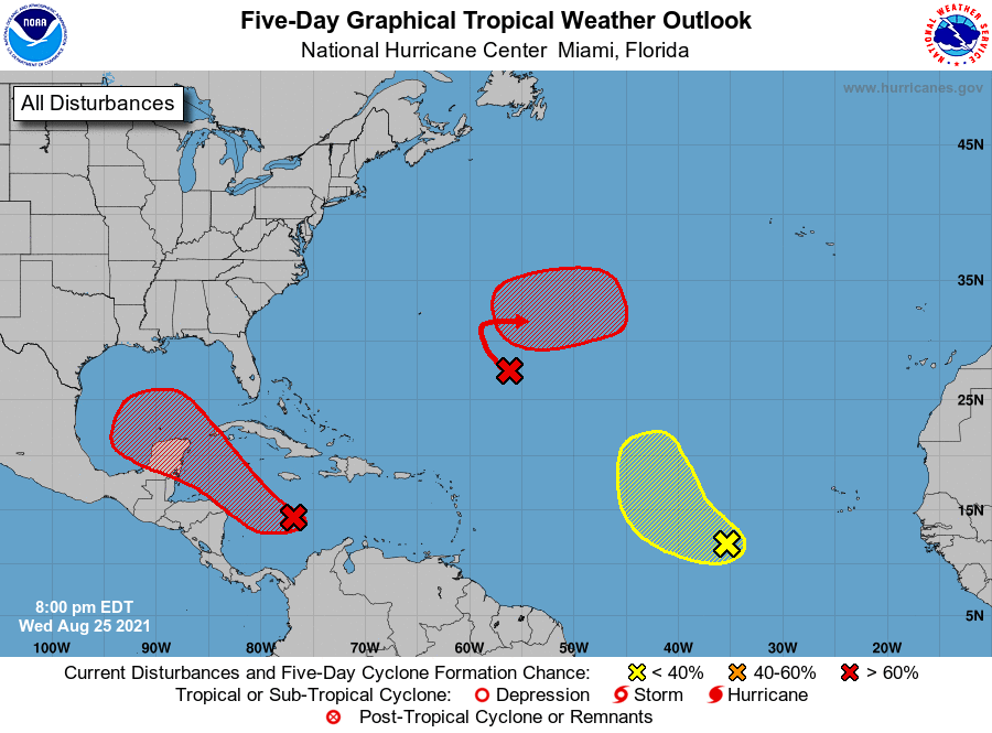
It won’t surprise you to know that the Atlantic is quite active right now. We are entering the peak time period of activity for tropical storms, and our best chance of having a named storm over the season occurs right around September 10. Today there are three areas of concern as shown in the map below from the National Hurricane Center. Two of these are rated at 80% chance of development, so we are likely to see Ida and Julian form in the next day or two. The one of most concern to use in the Southeast is the blob off the east coast of Mexico. It’s not well developed now, so predicting a future path is difficult, but the models generally agree that this one is likely to make landfall somewhere along the Louisiana or Texas coast. It could drop quite a bit of rain, but likely not as much as Hurricane Harvey did a few years ago on this date. Some signs indicate it is developing faster than expected, so the name could come tomorrow. Only a few of the model runs put it over Florida, Alabama, or Georgia, so that is a low probability for us. There are a few more runs across North Carolina and Virginia, but by the time it got there it would be mainly a rain event.
The other two centers of potential development do not look like they have any chance of affecting us in the Southeast or even in the US as a whole, so for now our eyes should be on the Caribbean, but not much concern at this point.