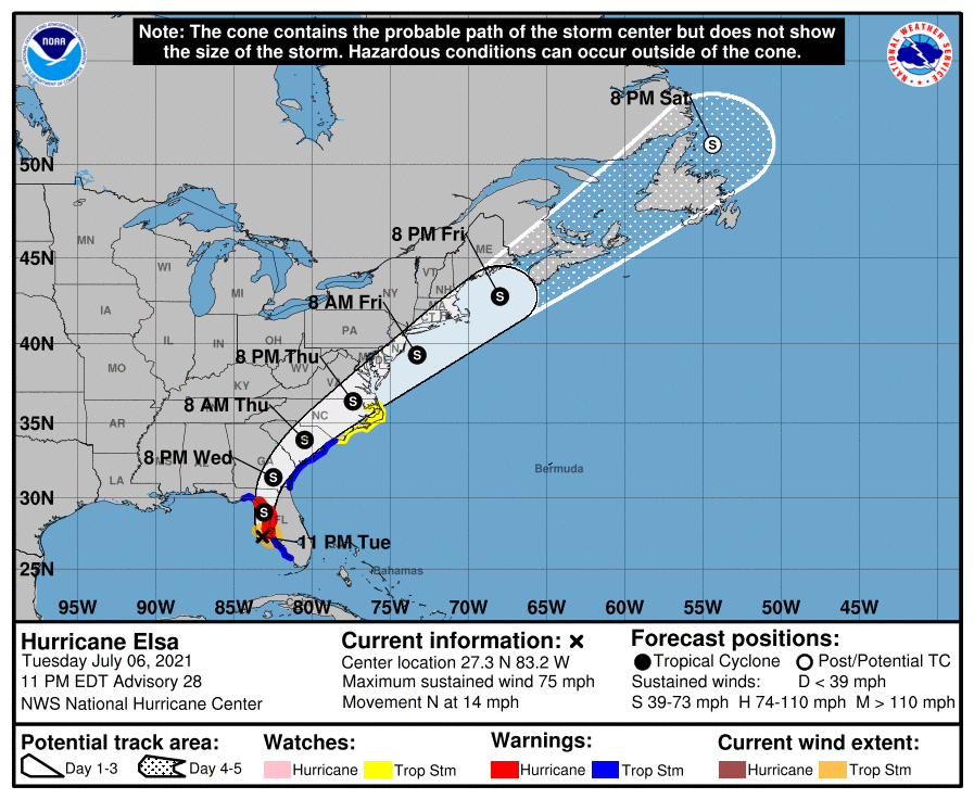
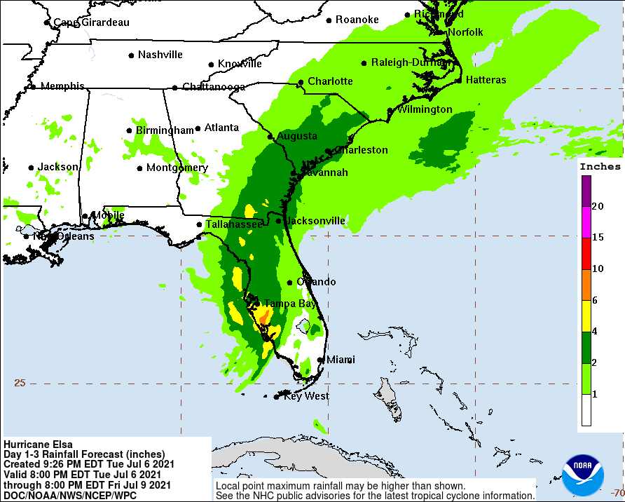
Elsa has restrengthened back to a hurricane after weakening earlier this weekend. It is now headed for the Cedar Key area in the Big Bend region of the northwest Florida Coast. I was interested to read from Brian McNulty, one of the hurricane specialists I follow, that “the last time a hurricane made landfall within 1° of that part of the coastline was Gladys in 1968. And the last time in July?? *1886*. Yes, that’s 135 years ago.” Once it comes onshore, it should weaken back to tropical storm status quickly but could continue as a tropical storm all the way up the East Coast before it crosses back into the Atlantic Ocean . That means heavy rain and strong winds will likely cause damage and a lot of flooding in northern Florida and southeastern Georgia over the next day before it moves off to the northeast through the Carolinas. If you are in the Florida peninsula, you have already seen some of the rain, small tornadoes, and winds from the storm, and if you are in its path on Wednesday, take care and do not drive into flooded roadways.