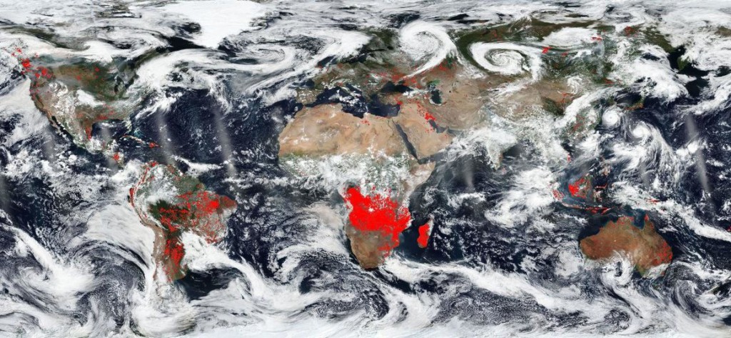
Did you know that NASA’s satellites can identify surface fires from space? They use the thermal imaging wavelength band to find hotspots that correspond with fires that are either wildfires or are human-set burns in agricultural areas. NASA produces a map which shows these fires across the globe. You can read more about the map at Atlas Obscura at https://www.atlasobscura.com/articles/map-of-worlds-wildfires.