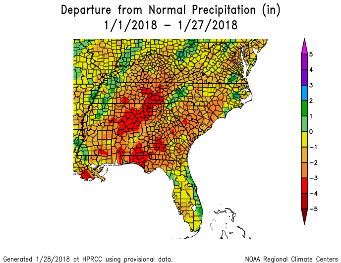
With just a couple of days to go before the end of the month, it looks like most of the Southeast will end up colder and drier than normal. This morning’s maps from the High Plains Regional Climate Center are shown below. Keep in mind that this map does not include the rain that many areas got on Sunday, so that should bring the departures up by about an inch in many places. I don’t expect to see much change to the temperature map. The dryness is certainly consistent with La Niña but the cold, not so much. Just shows that in a weak La Niña, other atmospheric patterns can also make a difference. It would not surprise me if February was also a cold month with the weather patterns we are seeing this year.