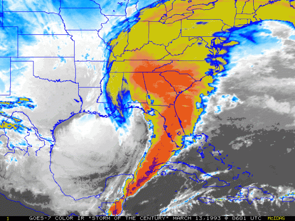
In 1993 I was working in Wisconsin as the State Climatologist watching an incredible storm forecast for the Southeast with my husband John Knox, Birmingham AL native. The forecast was one of the best the National Weather Service at the time ever made, and the severity of the storm was well predicted far ahead. Even so, they underestimated some aspects of the storm, including the storm surge that developed in Florida ahead of the low pressure. Here is a summary of the start of the storm from the NWS Wilmington NC office:
“Low pressure developed during the day of March 12th along a nearly stationary front lying along the Texas Gulf coast. Upper level conditions were very favorable for intensification of the low as a powerful jet streak developed across the eastern United States on the downwind side of a deep upper level trough. Strong horizontal temperature contrasts near the front across the Gulf Coast states, plus the development of deep thunderstorms over the Gulf also added fuel to the strengthening system. The low rapidly deepened as it crossed the Gulf of Mexico during the afternoon and evening of March 12th and made “landfall” along the Florida Panhandle just after midnight on March 13th. The U.S. Coast Guard rescued over 100 people from ships in distress during the storm.”
You can read the rest of the story at https://www.weather.gov/ilm/Superstorm93 and at https://www.alabamawx.com/?p=127791. John’s parents in Birmingham were trapped in their house for almost a week with no heat and 18 inches of snow on the ground. Amazing storm!