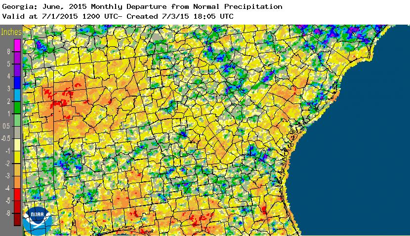
June 2015 ended up quite a bit warmer than normal across the state, but precipitation was variable. Some areas received well above normal rainfall, but others areas missed the beneficial rains and experienced increasing drought.
In Atlanta, the monthly average temperature was 79.6 degrees F (2.3 degrees above normal), in Athens 80.4 degrees (2.9 degrees above normal), Columbus 80.4 (0.6 degrees above normal), Macon 80.8 (1.9 above normal), Savannah 81.6 (1.8 above normal), Brunswick 81.2 (0.9 above normal), Alma 80.0 (1.1 above normal), Augusta 80.6 (2.0 above normal), Albany 81.4 (0.9 above normal) and Valdosta 81.3 (1.9 above normal).
The thermograph for Atlanta shows that for most of the month, both maximum and minimum temperatures were above their normal values, although the month started and ended cooler than normal. The warmest periods were in mid-June, with a return to hot temperatures a week later.
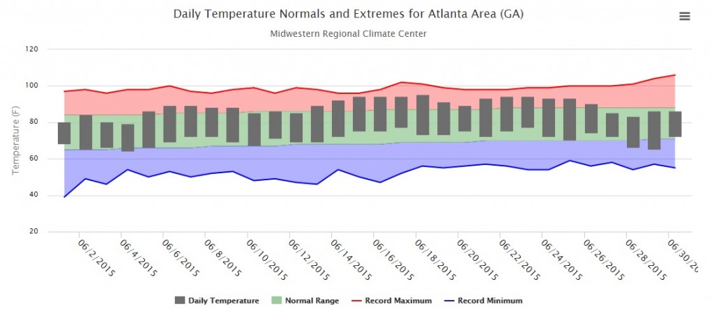
Atlanta and Athens broke their record high temperatures on June 8, reaching 87 F and 89 F respectively. This broke Atlanta’s record of 85 F set in 1978 and Athens’ record of 85 F set in 1989. Brunswick set a record high minimum temperature of 79 F on June 18, breaking the old record of 78 F set in 1952. Several other record high temperatures were tied this month.

The highest monthly total precipitation from National Weather Service reporting stations was 6.91 inches in Atlanta (2.96 inches above normal) and the lowest was in Athens at 2.76 inches (1.42 inches below normal). Augusta received 3.50 inches (1.22 below normal), Savannah received 5.63 inches (0.32 below normal), Macon received 3.78 inches (0.28 below normal), Columbus 4.07 (0.35 above normal), Albany 5.37 inches (0.43 above normal), Brunswick 4.02 inches (0.82 below normal), Alma 5.41 inches (0.03 above normal) and Valdosta 3.12 inches (2.94 below normal).
Macon set a daily high rainfall record of 2.02 inches on June 18, breaking the old record of 1.96 inches set in 1900.
The highest single-day rainfall from CoCoRaHS stations was 3.95 inches on June 10 near Riverdale in Clayton County followed by a Gwinnett County observer east of Buford reporting 3.50 inches two days later. The highest monthly total rainfall was 10.97 inches, observed by an observer north of Jesup in Wayne County, followed by 8.64 inches measured by another Jesup observer a few miles away.
There were 21 days with severe weather reported somewhere in the state. The vast majority of those reports were for high winds, with a few reports of hail. No tornadoes were reported in Georgia in June; the last time this occurred was 2012. Small hail caused some leaf damage to corn and other crops around the state.
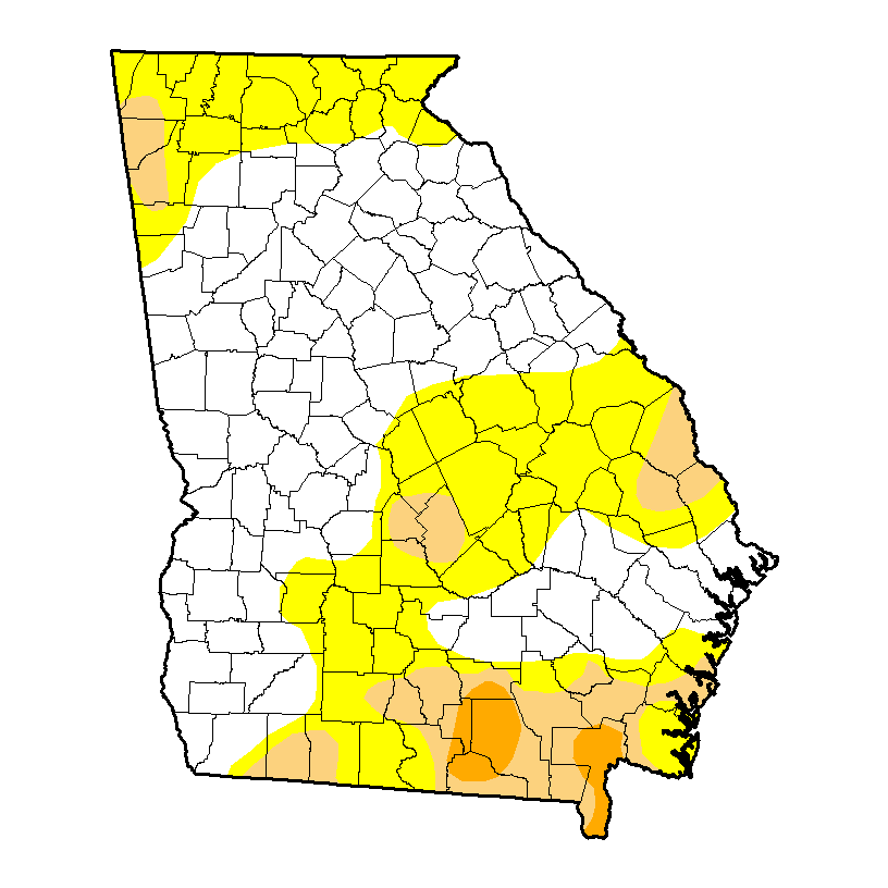
Because of the lack of rain and the above-normal temperatures, drought expanded in the southeast part of the state during the month and some severe drought was introduced. Moderate drought also appeared in northwest Georgia by the end of the month.
Some farmers were reporting crop and pasture problems due to the hot temperatures and lack of rain. The watermelon crop was hit particularly hard by the high temperatures. Corn was harvested ahead of schedule in some areas due to the high number of growing degree days it experienced. The heat was excellent for curing hay. Heavy rain in some areas caused severe erosion to a few fields in mid-month. Blueberry growers in north Georgia reported that there would not be many berries this year due to the frost in late March which killed the developing crop.
The University of Georgia announced that a concerted effort to conserve energy on the hottest days saved the university $175,000 in utility costs. The Turfgrass Center groundbreaking ceremony on June 24 was moved indoors due to the high temperatures that afternoon.
The outlook for July shows that warmer and drier than normal conditions are likely to occur across most of Georgia. This pattern is expected to continue for the next few months under the current El Nino.
For more information, please visit my blog at https://site.extension.uga.edu/climate or my web page at https://gaclimate.org.