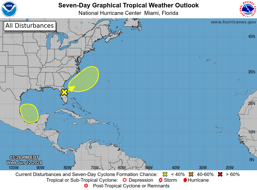
I am traveling this week but wanted to let you know that the National Hurricane Center is now showing two areas of potential development in the Gulf of Mexico in the next week. The first, designated as Investigation 90-L, is in the Eastern Gulf near Florida and is associated with the plume of moisture that has brought a foot or more of rain to some parts of southern Florida, with more on the way. The second area is in the southern Gulf and has a 30% potential of developing sometime in the next week. Neither area will become TS Alberto until a closed low pressure center is identified in the storm. Even if there is no official development, the heavy rain and potential for gusty winds could cause some impacts to affected areas. Impacts from the first storm will be limited to the Florida peninsula with a small potential for some high waves along the East Coast. Impacts from the second storm, if it occurs, depend on where it goes and that is too early to say.