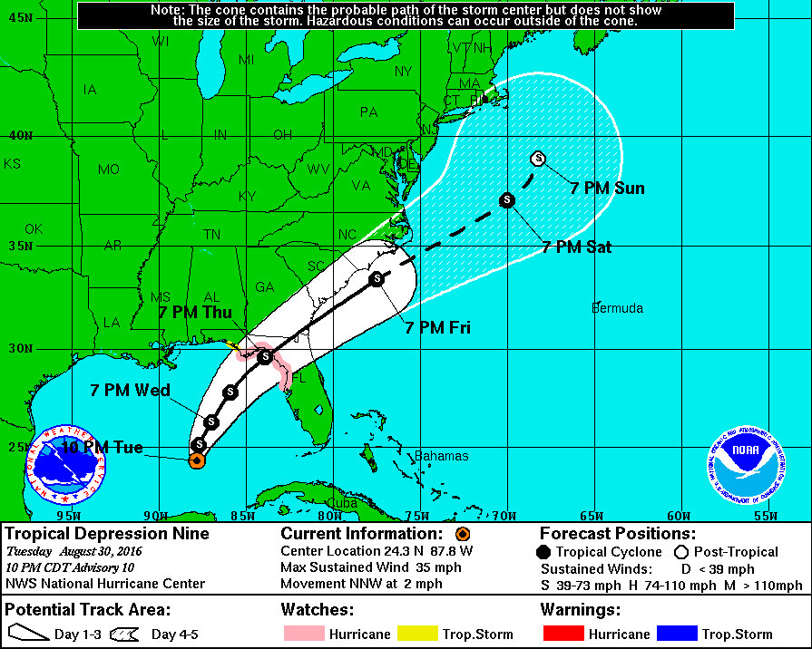
The latest update from the National Hurricane Center on Tropical Depression 9 shows that with its slow movement and development, it has not yet begun to move towards the northeast. This means that the updated most likely path has now moved north and west of its position earlier today. Most of the southeastern half of Georgia is now included in the forecast cone. This means that anywhere southeast of a line from roughly Bainbridge in the southwest corner of the state to just south of Macon to Augusta is potentially in the path of the storm at this point.
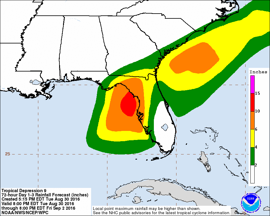
The forecast timing for the center of the path is for the storm to come onshore in the Big Bend Coast area of Florida around 7 pm on Thursday, proceeding northeast to reach Savannah by Friday morning and then heading up the coast continuing its northeast path before moving out to sea. If you are in that portion of Georgia or south into northern Florida, you should be watching conditions very carefully. It may become necessary to cancel events on Thursday or Friday depending on your location and how strong the storm becomes, although it is expected to stay at tropical storm strength. Rain of up to six inches may be seen in the far southeast part of Georgia and higher amounts in northern Florida.