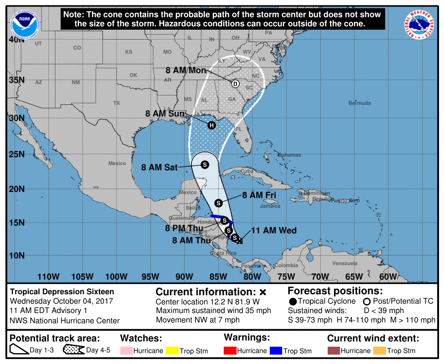
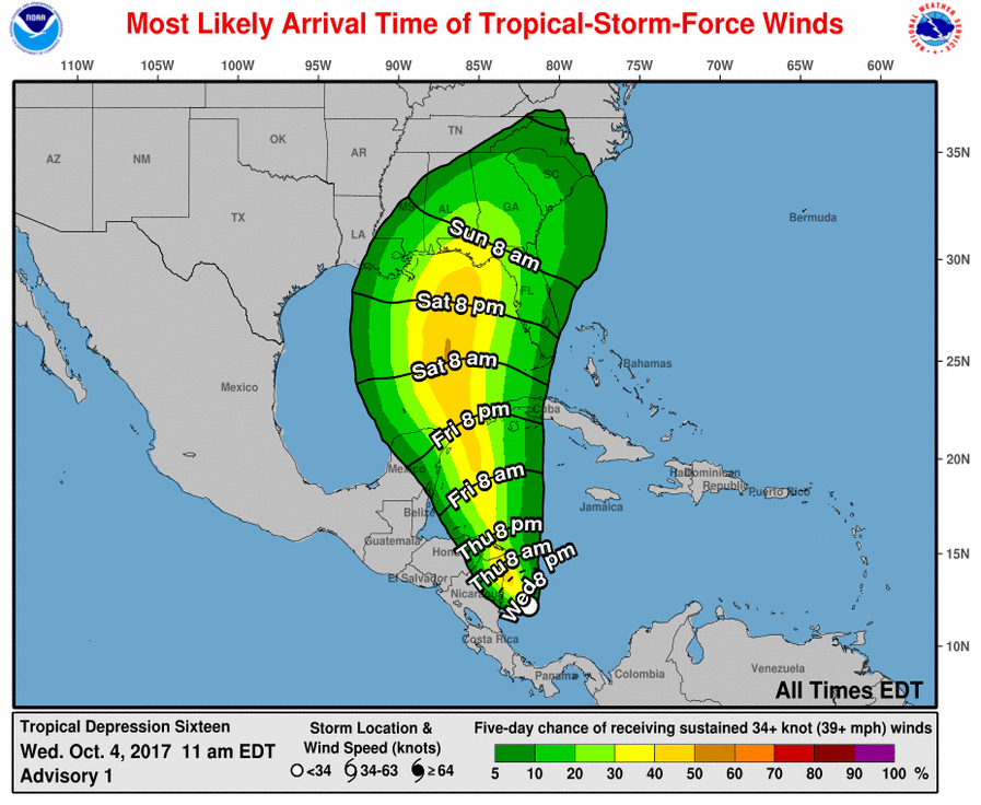
A new tropical depression has formed off the coast of Nicaragua and is expected to move north and strengthen over the next few days. Once it reaches tropical storm status, it will be called Nate. Models of the storm’s path indicate a high probability that it will move over parts of the Southeast by this weekend, although the Florida Keys could be affected by winds as early as Friday night. The Gulf of Mexico temperatures are quite warm and the storm is currently forecast to reach hurricane status by Sunday morning shortly before it is likely to come onshore somewhere between the Mississippi coast and Tampa FL.
Nate is likely to bring heavy rain, tropical storm force winds and some isolated tornadoes to the region, especially in areas to the right of the path of the central circulation. If you have outdoor activities scheduled for this weekend or early next week, you should keep abreast of current forecasts and prepare for nasty conditions with the storm. Some areas in Alabama and western Georgia that received minimal impacts from Irma could see stronger winds and rain in this storm just due to the relative paths of the storms. Official updated forecasts are available at https://www.hurricanes.gov.