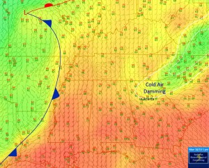
This surface temperature map and weather analysis shows the changes that are coming to the Southeast as the next cold front passes. On this map from Chris Robbin’s Facebook page, you can see the cold air behind the advancing cold front, which is just to the west of Mississippi. The remains of the cold air “wedge” are still visible in northeast Georgia and stretching up into SC and NC as well. The cold air wedge is expected to retreat to the northeast, which will increase the chances for severe weather in northeast Georgia on Tuesday.