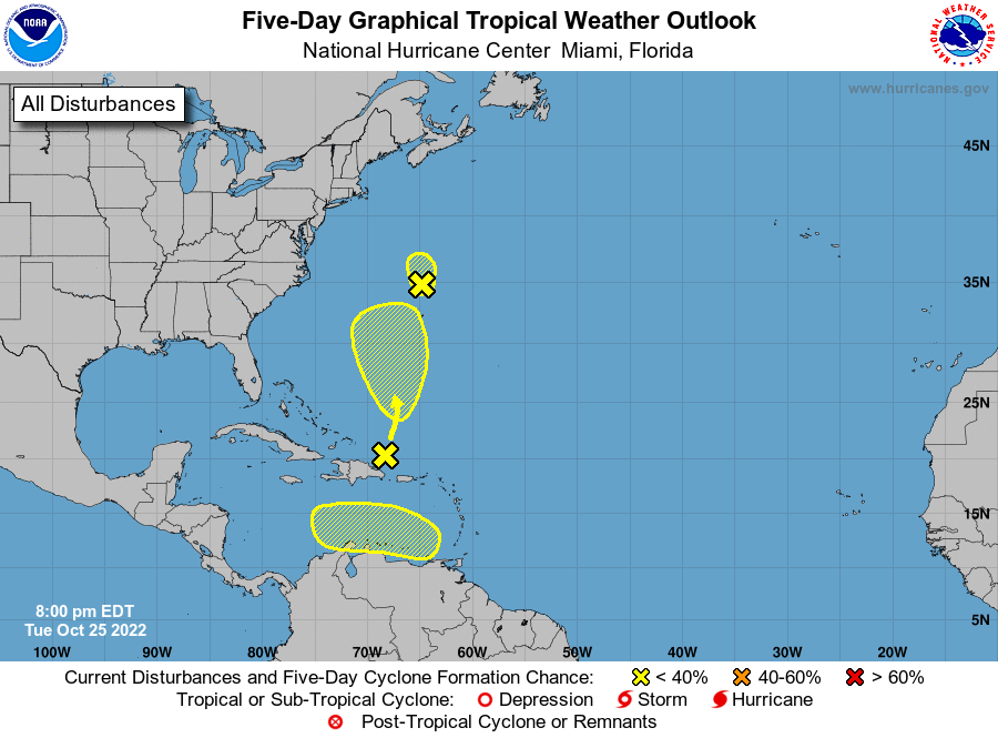
Even though the tropics have been quiet since Hurricane Ian developed and followed its path through Florida and the Carolinas, there is still some sign of life in the Atlantic Basin. Today there are three areas with a low probability of developing into a named storm. The area off the East Coast is designated as Investigation 94L, and it has a short window of developing into a tropical storm that is expected to move north, so it won’t affect us in the Southeast. Some of the long-range models are suggesting that the area in the southern Caribbean could develop into a named storm sometime next week, but that is a long way off in space and time so for now, just keep an eye out to see what happens. Remember, the Atlantic tropical season officially ends on November 30, but occasionally a storm will form after that date, so don’t let your guard down completely yet.