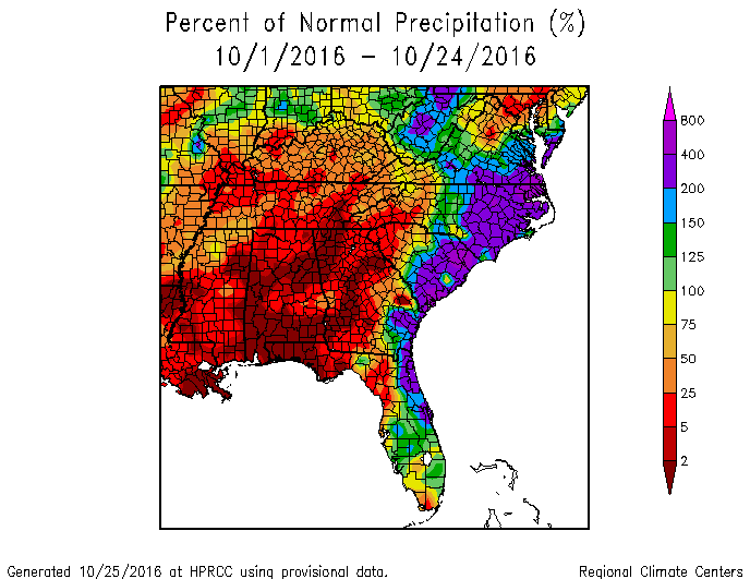
Extremely dry conditions are present over many areas of the Southeast, while others are still digging out from the flooding of Hurricanes Matthew, Hermine, and Julia. The map from the High Plains Regional Climate Center shows the percent of normal rain that has occurred since the beginning of October across the Southeast. The region under the gun from the tropical systems can clearly be seen while other areas are at near-zero rainfall, including many areas that are presently under extreme or exceptional drought. With this severe lack of rainfall, drought conditions are likely to expand again this week in Thursday’s new Drought Monitor.
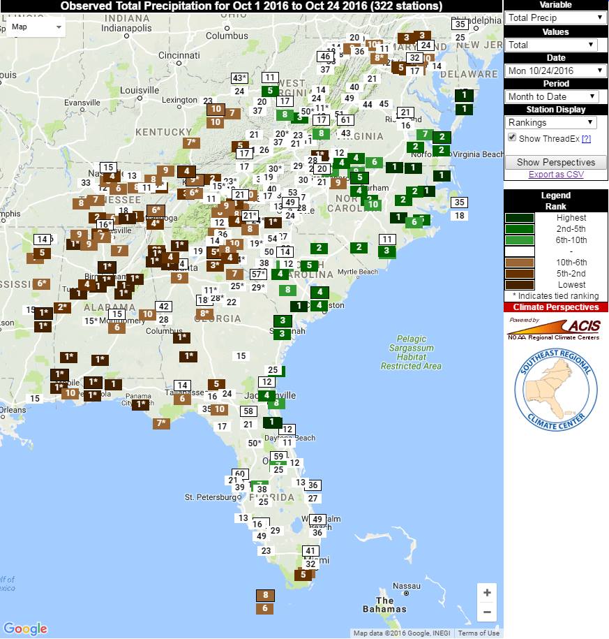
The map from the Southeast Regional Climate Center’s Perspectives tool shows the ranking of October to date rainfall for stations around the Southeast, and you can again see the bifurcated nature of the rain, with many areas in the eastern Carolinas ranking near the wettest while areas in the western part of the region are in the top five driest.