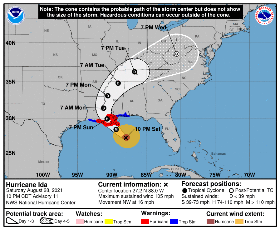
As of 11 pm, Hurricane Ida has winds of 105 mph and is continuing to head to the coast of Louisiana, where it is expected to make landfall as a major hurricane near New Orleans. The forecasts have been nudging slightly east, but it’s not clear if that will continue or not. Any changes to the path at this point are likely to be fairly small. The parts of the Southeast that are likely to be the most affected are western Alabama and then Virginia as the remains of Ida move through the area Tuesday and Wednesday. Some lesser impacts could be seen in the northwestern and southwestern corners of Georgia, with a potential for wind gusts to 50 mph in the far NW and rainfall of 1-2 inches in northern Georgia, especially in the mountains. Some gusty winds, bursts of heavy rain, and even a few tornadoes are likely to be seen in western Alabama and could occur in the corners of Georgia if the storm holds together. A lot of the east coasts of Georgia and the Carolinas will see little rain and potentially a lot of sunshine (although some high clouds blowing off of Ida) as they will be in the sinking air outside the storm. Prayers for those in Louisiana, including New Orleans and Baton Rouge, since they should start feeling the effects by Sunday morning, including a storm surge if the storm moves west or over the city and up to 15 inches of rain on top of that.